Pukara (Moquegua)
| Pukara | |
|---|---|
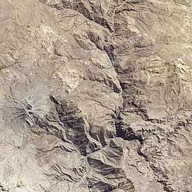 Satellite image of the volcano Ubinas (on the left) with Pukara northeast of it | |
| Highest point | |
| Elevation | 4,400 m (14,400 ft) [1] |
| Coordinates | 16°20′10″S 70°51′03″W / 16.33611°S 70.85083°WCoordinates: 16°20′10″S 70°51′03″W / 16.33611°S 70.85083°W |
| Geography | |
 Pukara Peru | |
| Location | Peru, Moquegua Region, General Sánchez Cerro Province |
| Parent range | Andes |
Pukara (Aymara and Quechua for fortress,[2] hispanicized spelling Pucara) is a mountain in the Moquegua Region in the Andes of Peru, about 4,400 metres (14,436 ft) high. It is located in the General Sánchez Cerro Province, Ubinas District. Pukara is situated northeast of the active volcano Ubinas and southwest of Wit'uni. The Para River flows along its western slopes.[1][3]
See also
References
- 1 2 escale.minedu.gob.pe - UGEL map of the General Sánchez Cerro Province (Arequipa Region)
- ↑ Radio San Gabriel, "Instituto Radiofonico de Promoción Aymara" (IRPA) 1993, Republicado por Instituto de las Lenguas y Literaturas Andinas-Amazónicas (ILLLA-A) 2011, Transcripción del Vocabulario de la Lengua Aymara, P. Ludovico Bertonio 1612 (Spanish-Aymara-Aymara-Spanish dictionary)
- ↑ Peru 1:100,000, Lloque 2738, Map prepared and published by the Defense Mapping Agency, Hydrographic/Topographic Center, Bethesda, MD
This article is issued from
Wikipedia.
The text is licensed under Creative Commons - Attribution - Sharealike.
Additional terms may apply for the media files.