Puhinui railway station
Puhinui | |||||||||||||||
|---|---|---|---|---|---|---|---|---|---|---|---|---|---|---|---|
| Auckland Transport Urban rail | |||||||||||||||
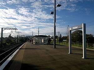 The station in 2014, looking north. | |||||||||||||||
| Location | Papatoetoe, Auckland | ||||||||||||||
| Coordinates | 36°59′21″S 174°51′21″E / 36.989082°S 174.855706°E | ||||||||||||||
| Owned by | KiwiRail and Auckland Transport | ||||||||||||||
| Line(s) | Eastern Line, Southern Line | ||||||||||||||
| Platforms | Island platform | ||||||||||||||
| Tracks | Mainline (2) | ||||||||||||||
| Construction | |||||||||||||||
| Platform levels | 1 | ||||||||||||||
| Parking | No | ||||||||||||||
| Bicycle facilities | No | ||||||||||||||
| Other information | |||||||||||||||
| Station code | PHU | ||||||||||||||
| History | |||||||||||||||
| Opened | 29 June 1925 | ||||||||||||||
| Electrified | 25kV AC[1] | ||||||||||||||
| Traffic | |||||||||||||||
| Passengers (2011) | 676 passengers/weekday[2] | ||||||||||||||
| Services | |||||||||||||||
| |||||||||||||||
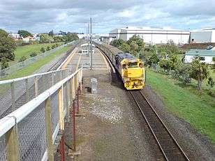
Puhinui railway station is a station of the Auckland rail network and is located near Papatoetoe, Auckland, New Zealand. Passenger services on the Eastern Line and Southern Line use the station. It has an island platform and an enclosed shelter relocated from Papatoetoe station. It is accessed from Puhinui Road from both sides of the tracks via a pedestrian bridge located at the site of a former level crossing (Puhinui Road itself now crosses on a bridge approximately 120m north of the pedestrian bridge).
South of this station, Eastern Line and Southern Line services diverge, the Eastern onto the Manukau Branch which terminates at Manukau. The Southern continues south via Homai toward Papakura.
The station was opened on 29 June 1925 for passengers. Goods services closed on 12 May 1958.[3]
Services
Transdev Auckland, on behalf of Auckland Transport, operates suburban services to Britomart, Manukau, Papakura and Pukekohe via Puhinui. The typical weekday off-peak timetable is:[4][5]
- 6 trains per hour (tph) to Britomart, consisting of:
- 3 tph via Glen Innes (Eastern Line)
- 3 tph via Penrose and Newmarket (Southern Line)
- 3 tph to Manukau
- 3 tph to Papakura
See also
References
- ↑ "Auckland Electrifcation Map" (PDF). KiwiRail. 28 April 2014. Retrieved 11 July 2014.
- ↑ Auckland Transport Board Meeting (20 November 2012) Agenda Item 10(i) "Rail Electrification Extension" Archived 14 December 2012 at the Wayback Machine. p. 16
- ↑ Scoble, Juliet (2012). Names & Opening & Closing Dates of Railway Stations in New Zealand, 1863 to 2012. Wellington. p. 105.
- ↑ "Eastern Line timetable" (PDF). Auckland Transport. Archived from the original (PDF) on 27 January 2016. Retrieved 10 June 2016.
- ↑ "Southern Line timetable" (PDF). Auckland Transport. Archived from the original (PDF) on 24 June 2016. Retrieved 10 June 2016.
Coordinates: 36°59′23″S 174°51′22″E / 36.9897°S 174.8561°E