Central Manitoulin
| Central Manitoulin | |
|---|---|
| Township (single-tier) | |
| Municipality of Central Manitoulin | |
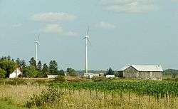 Countryside near Spring Bay | |
 Central Manitoulin | |
| Coordinates: 45°43′N 82°12′W / 45.717°N 82.200°WCoordinates: 45°43′N 82°12′W / 45.717°N 82.200°W | |
| Country |
|
| Province |
|
| District | Manitoulin |
| Government | |
| • Reeve | Richard Stephens |
| • Federal riding | Algoma—Manitoulin—Kapuskasing |
| • Prov. riding | Algoma—Manitoulin |
| Area[1] | |
| • Land | 431.53 km2 (166.61 sq mi) |
| Population (2011)[1] | |
| • Total | 1,958 |
| • Density | 4.5/km2 (12/sq mi) |
| Time zone | UTC-5 (EST) |
| • Summer (DST) | UTC-4 (EDT) |
| Postal Code FSA | P0P |
| Area code(s) | 705 |
| Website |
www |
Central Manitoulin is a township in the Canadian province of Ontario. It is located on Manitoulin Island and in Manitoulin District.
Communities
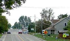
The primary community and administrative centre of the township is Mindemoya. Smaller communities include Big Lake, Britainville, Dryden's Corner, Gibraltar, Grimsthorpe, Long Bay, Monument Corner, Old Spring Bay, Perivale, Providence Bay, Sandfield and Spring Bay.
 Mindemoya |
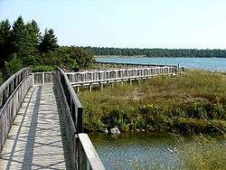 Providence Bay |
Notable locations
Ontario has had a few historical claimants, by towns, for housing the province's smallest jail. The main three being: Tweed, Creemore and Coboconk. However, old jailhouses in Providence Bay, Port Dalhousie, Rodney, and ghost town Berens River have proven to be even smaller. The jailhouse in Providence Bay is now a cabin for tourists to stay at. Treasure Island, the largest island in a lake on an island in a lake, is located in Central Manitoulin, in Lake Mindemoya. The largest lake in a lake, Lake Manitou, is also mainly located in Central Manitoulin.
Demographics
| Canada census – Central Manitoulin community profile | |||
|---|---|---|---|
| 2011 | 2006 | ||
| Population: | 1958 (0.7% from 2006) | 1944 (1.9% from 2001) | |
| Land area: | 431.53 km2 (166.61 sq mi) | 431.53 km2 (166.61 sq mi) | |
| Population density: | 4.5/km2 (12/sq mi) | 4.5/km2 (12/sq mi) | |
| Median age: | 51.4 (M: 51.6, F: 51.2) | ||
| Total private dwellings: | 1541 | 1552 | |
| Median household income: | $47,148 | ||
| References: 2011[2] 2006[3] earlier[4] | |||
See also
References
- 1 2 "Central Manitoulin census profile". 2011 Census of population. Statistics Canada. Retrieved 2012-02-22.
- ↑ "2011 Community Profiles". Canada 2011 Census. Statistics Canada. July 5, 2013. Retrieved 2012-02-22.
- ↑ "2006 Community Profiles". Canada 2006 Census. Statistics Canada. March 30, 2011. Retrieved 2012-02-22.
- ↑ "2001 Community Profiles". Canada 2001 Census. Statistics Canada. February 17, 2012.
External links
| Wikimedia Commons has media related to Central Manitoulin. |
Places adjacent to Central Manitoulin | |
|---|---|