Pronghorn, Oregon
| Pronghorn, Oregon | |
|---|---|
| Census-designated place | |
 Pronghorn Location in the state of Oregon  Pronghorn Pronghorn (the US) | |
| Coordinates: 44°11′09″N 121°10′21″W / 44.18583°N 121.17250°WCoordinates: 44°11′09″N 121°10′21″W / 44.18583°N 121.17250°W | |
| Country | United States |
| State | Oregon |
| County | Deschutes |
| Area | |
| • Total | 6.6 sq mi (17.1 km2) |
| • Land | 6.6 sq mi (17.1 km2) |
| • Water | 0.0 sq mi (0.0 km2) |
| Elevation | 3,200 ft (1,000 m) |
| Population (2010) | |
| • Total | 34 |
| • Density | 5/sq mi (2.0/km2) |
| Time zone | UTC-8 (Pacific (PST)) |
| • Summer (DST) | UTC-7 (PDT) |
| FIPS code | 41-60070[1] |
| GNIS feature ID | 2584421[2] |
Pronghorn is a census-designated place (CDP) and resort community in Deschutes County, Oregon, United States. It is part of the Bend, Oregon Metropolitan Statistical Area. The residential population was 34 at the 2010 census.[1] It comprises the Pronghorn Golf Club, located 4 miles (6 km) south of Redmond.
References
- 1 2 "Geographic Identifiers: 2010 Demographic Profile Data (G001): Pronghorn CDP, Oregon". U.S. Census Bureau, American Factfinder. Retrieved December 14, 2015.
- ↑ U.S. Geological Survey Geographic Names Information System: Pronghorn Census Designated Place
Municipalities and communities of Deschutes County, Oregon, United States | ||
|---|---|---|
| Cities | 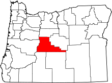 | |
| CDPs | ||
| Other unincorporated communities | ||
This article is issued from
Wikipedia.
The text is licensed under Creative Commons - Attribution - Sharealike.
Additional terms may apply for the media files.