Promontorium Fresnel
Coordinates: 28°38′N 4°45′E / 28.633°N 4.750°E

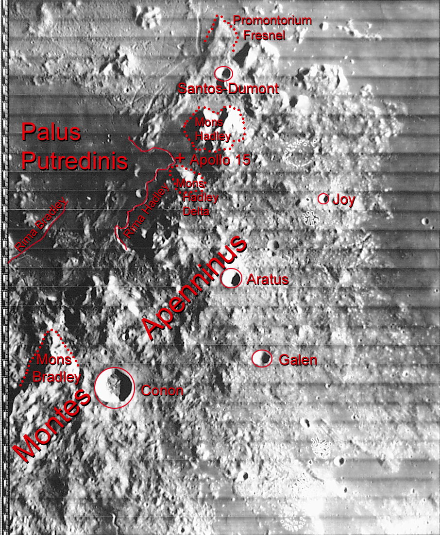
Promontorium Fresnel (Latin for "Cape Fresnel") is a raised mountainous cape of the Nearside of the Moon, located in the northernmost of the Lunar Apennines and separates the lunar mares (seas) of Imbrium and Serenity. Its length is about 20 km. To the south are Mons Hadley (Mount Hadley) and the Santos-Dumont Crater, northwest is the crater Autolycus and northeast are the Lunar Caucasus (Montes Caucasus). Just west of the mountainous cape is Rimae Fresnel. Both the nearby escarpment and the cape were named after the French mathematician Augustin Jean Fresnel.[1][2] Its coordinates are 28°38′N 4°45′E / 28.633°N 4.750°E.
Before the 1651 nomenclature, Michael van Langren's 1645 map calls it "Mariae, D. Mant. E." and thought the feature was a large crater[3][4] After that, the feature would be nameless for a few centuries.
References
- ↑ "Promontorium Fresnel". Gazetteer of Planetary Nomenclature. USGS Astrogeology Research Program. Accessed August 14, 2017
- ↑ "Fresnel summary". August 2002. Archived February 5, 2012.
- ↑ Langren, Michael van (1645). "Map of the Moon in the book Plenilunii lumina Austriaca Philippica".
- ↑ Ewen A. Whitaker, Mapping and Naming the Moon (Cambridge University Press, 1999), p. 198.
External links
| Wikimedia Commons has media related to Promontorium Fresnel. |
- Promontorium Fresnel at the Moon Wiki
- Lunar Orbiter images of Promontorium Fresnel
- Promontorium Fresnel at Google Moon
Related article
- Wood, Chuck (May 4, 2013). "Topographic Revelations". Lunar Photo of the Day. Retrieved August 16, 2017.