Pradera
| Pradera | ||
|---|---|---|
| Municipality and town | ||
| ||
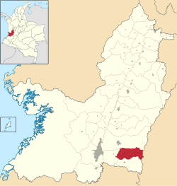 Location of the municipality and town of Pradera in the Valle del Cauca Department of Colombia. | ||
| Coordinates: 3°25′16″N 76°14′41″W / 3.42111°N 76.24472°W | ||
| Country |
| |
| Department | Valle del Cauca Department | |
| Founded | 1862 | |
| Government | ||
| • Mayor | Adolfo León Escobar Pineda | |
| Area | ||
| • Total | 407 km2 (157 sq mi) | |
| Elevation | 1,070 m (3,510 ft) | |
| Population (2012) | ||
| • Total | 45,360 | |
| • Density | 110/km2 (290/sq mi) | |
| Demonym(s) | Pradereña | |
| Time zone | UTC-5 (Colombia Standard Time) | |
| Area code(s) | 57 + 2 | |
| Website | Official website (in Spanish) | |

Pradera (Spanish pronunciation: [pɾaˈðeɾa]) is a town and municipality located in the Department of Valle del Cauca, Colombia.
The FARC requested this municipality together with Florida, Valle del Cauca as free areas for them to operate in order to start the negotiation to exchange 44 hostages they had, at the time of their request, for guerrilla fighters kept in prison by the Colombian government.[1][2]
References
This article is issued from
Wikipedia.
The text is licensed under Creative Commons - Attribution - Sharealike.
Additional terms may apply for the media files.