Pottsville, Texas
| Pottsville, Texas | |
|---|---|
| Unincorporated community | |
 Pottsville  Pottsville | |
| Coordinates: 31°40′24″N 98°19′32″W / 31.67333°N 98.32556°WCoordinates: 31°40′24″N 98°19′32″W / 31.67333°N 98.32556°W | |
| Country | United States |
| State | Texas |
| County | Hamilton |
| Elevation | 1,322 ft (403 m) |
| Time zone | UTC-6 (Central (CST)) |
| • Summer (DST) | UTC-5 (CDT) |
| ZIP codes | 76565 |
| GNIS feature ID | 1344442 |
Pottsville is an unincorporated community located in western Hamilton County in Central Texas. It lies along Fm-218 west of the city of Hamilton, the county seat of Hamilton County.[1] Its elevation is 1,322 feet (403 m).[2] Although Pottsville is unincorporated, it has a post office, with the ZIP code of 76565;[3] the ZCTA for ZIP Code 76565 had a population of 142 at the 2000 census.[4]
Named for early settler John Potts, the community was founded as a dry town in 1872. Its first school was founded in 1876, and the post office was established in 1879. Pottsville has undergone multiple catastrophes: every business was burned in a 1913 fire, and great damage was done by a 1944 tornado. The school and post office have since closed, and the youth in the town attend school in Hamilton.[5]
Climate
The climate in this area is characterized by relatively high temperatures and evenly distributed precipitation throughout the year. The Köppen Climate System describes the weather as humid subtropical, and uses the abbreviation Cfa.[6]
References
- ↑ Rand McNally. The Road Atlas '08. Chicago: Rand McNally, 2008, p. 100.
- ↑ U.S. Geological Survey Geographic Names Information System: Pottsville, Texas
- ↑ Zip Code Lookup
- ↑ "American FactFinder". United States Census Bureau. Retrieved 2008-01-31.
- ↑ Pottsville, Texas, Handbook of Texas Online, 2008-01-18. Accessed 2008-08-14.
- ↑ Climate Summary for Pottsville, Texas
External links
Municipalities and communities of Hamilton County, Texas, United States | ||
|---|---|---|
| Cities | 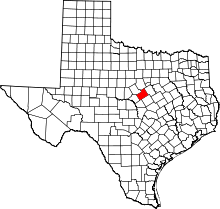 | |
| Town | ||
| Unincorporated communities | ||
| Ghost town | ||
| Footnotes | ‡This populated place also has portions in an adjacent county or counties | |