Pottersburg, Ohio
| Pottersburg, Ohio | |
|---|---|
| Unincorporated community | |
 Pottersburg, Ohio Location of Pottersburg, Ohio | |
| Coordinates: 40°15′58″N 83°30′03″W / 40.26611°N 83.50083°W | |
| Country | United States |
| State | Ohio |
| Counties | Union |
| Elevation[1] | 1,089 ft (332 m) |
| Time zone | UTC-5 (Eastern (EST)) |
| • Summer (DST) | UTC-4 (EDT) |
| ZIP code | 43040 |
| Area code(s) | 937 |
| GNIS feature ID | 1057936[1] |
Pottersburg (originally known as Pottersburgh) is an unincorporated community in Allen Township, Union County, Ohio, United States. It is located at 40°15′58″N 83°30′03″W / 40.26611°N 83.50083°WCoordinates: 40°15′58″N 83°30′03″W / 40.26611°N 83.50083°W,[2] along U.S. Route 33 between Marysville and Bellefountaine, about four miles west of Marysville.[3]
Pottersburg was laid out along the Atlantic and Great Western Railroad in 1868.[4] That same year, a sawmill was built. The Pottersburg Post Office was originally established as the Pottersburgh Post Office on June 29, 1869.[5] In 1872, the railway company built a railroad depot and a telegraph office. As of 1877, the community contained two stores, one warehouse, one telegraph office, and the district school-house.[4] The post office name was changed to Pottersburg Post Office on June 1, 1894, and later discontinued on October 30, 1926. The mail service is delivered through the Marysville branch.[5]
References
- 1 2 "US Board on Geographic Names". United States Geological Survey. 2007-10-25. Retrieved 2008-01-31.
- ↑ U.S. Geological Survey Geographic Names Information System: Pottersburg, Ohio
- ↑ Rand McNally. The Road Atlas '06. Chicago: Rand McNally, 2006, 78.
- 1 2 A.S. Mowry, C.E., Atlas of Union County, Ohio, Harris, Sutton & Hare, Philadelphia, 1877, Pg. 19.
- 1 2 U.S. Geological Survey Geographic Names Information System: Pottersburg Post Office
Municipalities and communities of Union County, Ohio, United States | ||
|---|---|---|
| Cities | 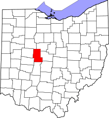 | |
| Villages | ||
| Townships | ||
| CDPs | ||
| Unincorporated communities | ||
| Ghost town | ||
| Footnotes | ‡This populated place also has portions in an adjacent county or counties | |