Portomaggiore
| Portomaggiore | ||
|---|---|---|
| Comune | ||
| Comune di Portomaggiore | ||
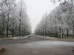 A snow-covered alley in Portomaggiore. | ||
| ||
 Portomaggiore Location of Portomaggiore in Italy | ||
| Coordinates: 44°42′N 11°48′E / 44.700°N 11.800°ECoordinates: 44°42′N 11°48′E / 44.700°N 11.800°E | ||
| Country | Italy | |
| Region | Emilia-Romagna | |
| Province | Ferrara (FE) | |
| Frazioni | Gambulaga, Maiero, Portorotta, Portoverrara, Quartiere, Ripapersico, Runco, Sandolo | |
| Government | ||
| • Mayor | Nicola Minarelli | |
| Area | ||
| • Total | 126 km2 (49 sq mi) | |
| Elevation | 2 m (7 ft) | |
| Population (31 December 2007) | ||
| • Total | 12,272 | |
| • Density | 97/km2 (250/sq mi) | |
| Demonym(s) | Portuensi | |
| Time zone | UTC+1 (CET) | |
| • Summer (DST) | UTC+2 (CEST) | |
| Postal code | 44015 | |
| Dialing code | 0532 | |
| Patron saint | St. Charles Borromeo | |
| Website | Official website | |

Portomaggiore (Ferrarese: Portmagiòr) is a town and comune in the province of Ferrara, Emilia-Romagna, Italy.
History
In the Battle of Portomaggiore of 1395, mercenary troops of the Ferrara Regency Council, assisted by allies from Florence, Bologna, Venice and fighting in the name of the young Niccolò III d'Este, Marquis of Ferrara beat the rebel forces of his uncle, Azzo X d'Este, pretender to the Lordship of Ferrara. Azzo X d'Este was captured in the battle.[1]
Main sights
The main attraction of the comune is the Delizia del Verginese, in the frazione of Gambulaga, a castle-residence built by Duke Alfonso I d'Este in the early 16th century.
Notable residents
Davide Santon and Marcella Tonioli, an Italian compound archer, were born in Portamaggiore.
References
- ↑ authors, Various. Medieval Wars 500–1500.
External links
 | ||
This article is issued from
Wikipedia.
The text is licensed under Creative Commons - Attribution - Sharealike.
Additional terms may apply for the media files.