Porto Martins
| Porto Martins | |
| Civil Parish | |
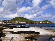 A panoramic vista of the coast of Porto Martins, and the extinct spatter cone Capitão | |
| Official name: Freguesia de Porto Martins | |
| Name origin: Portuguese for Martins Port | |
| Country | |
|---|---|
| Autonomous Region | |
| Island | Terceira |
| Municipality | Praia da Vitória |
| Localities | Ponta da Maria, Ponta Negra, Porto do São Fernando, Porto Martins, Praia de Porto Martins, Nossa Senhora dos Remédios, Recanto, Santo António, Serra, Santa Margarida |
| Center | Porto Martins |
| - coordinates | 38°41′8″N 27°3′44″W / 38.68556°N 27.06222°WCoordinates: 38°41′8″N 27°3′44″W / 38.68556°N 27.06222°W |
| Highest point | Capitão |
| - elevation | 150 m (492 ft) |
| - coordinates | 38°41′29″N 27°3′31″W / 38.69139°N 27.05861°W |
| Lowest point | Sea level |
| - location | Atlantic Ocean |
| - elevation | 0 m (0 ft) |
| Area | 3.43 km2 (1 sq mi) |
| - urban | .89 km2 (0 sq mi) |
| Population | 1,001 (2011) |
| Density | 292/km2 (756/sq mi) |
| LAU | Junta Freguesia |
| - location | Rua Capitão João B. Pamplona |
| President Junta | Ana Rita Meneses Branco (PS) |
| Timezone | Azores (UTC-1) |
| - summer (DST) | Azores (UTC0) |
| Postal Zone | 9760-090 |
| Area Code & Prefix | (+351) 292 XXX-XXXX |
| Patron Saint | Santa Margarida |
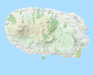 Location of the parish seat of Porto Martins on the island of Terceira | |
| Wikimedia Commons: Porto Martins (Praia da Vitória) | |
| Website: www | |
| Geographic detail from Instituto Geográfico Português (2010) | |
Porto Martins is a civil parish in the municipality of Praia da Vitória, on the island of Terceira in the Portuguese Azores. The population in 2011 was 1,001,[1] in an area of 3.43 km².[2]
History
Porto Martins was deannexed from the neighbouring parish of Cabo da Praia on 9 May 2001.[3]
The parish owes a lot to the philanthropy of José Coelho Pamplona, 1st Viscount of Porto Martim, a native of the parish, who donated funds towards the construction of the parochial church, expanding the older Chapel of Santa Margarida, the primary school, in addition to the primitive system of fountains, which supported the local population. The Viscount was an illustrious figure in the Portuguese community in São Paulo.
Geography
Porto Martins landscape is varied, characterized by rock-covered vineyards and orchards, particularly olive fields, which are uncharacteristic of the humid climate.
Architecture
Civic
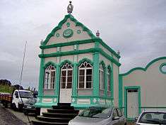
- Chafariz do Largo Comendador Pamplona
Military
- Fort of Nossa Senhora da Nazaré (English: Fort of Our Lady of Nazareth)
- Fort of São Bento (English: Fort of Saint Benedict)
- Fort of São Filipe (English: Fort of Saint Phillip)
Religious
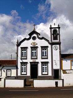
- Parochial Church of Porto Martins
- Império of the Divino Espírito Santo