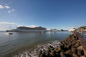
Port of Funchal
| Port of Funchal | |
|---|---|
 Port of Funchal | |
| Location | |
| Country | Portugal |
| Location | Funchal, Madeira |
| Coordinates | 32°38′33.5″N 16°54′58.7″W / 32.642639°N 16.916306°WCoordinates: 32°38′33.5″N 16°54′58.7″W / 32.642639°N 16.916306°W |
| Details | |
| Opened | 1762 |
|
Website http://www.apram.pt/site/index.php/en/ | |
The Port of Funchal is the port and harbour of Funchal and is frequently used as a stop-over by transatlantic ships, en route from Europe to the Caribbean, as it is the northern most Atlantic island that lies in the path of the Westerlies.
History
The Port of Funchal was the only major port in Madeira until 2007 when it became fully dedicated to passenger transport – cruise ships and ferries – and other tourist-related boats and yachts. In that year all remaining fishing activity and cargo trade was moved to the newly developed port of Caniçal, 12 mi (19 km) to the east.[1] A ferry between Funchal and Portimao, on the mainland, provided by Naviera Armas used to sail weekly, but was discontinued in 2013 due to a dispute over harbour fees. A ferry called Lobo Marinho runs in two hours between Funchal and Porto Santo Island.[2]
Destinations
- Porto Santo by Lobo Marinho
See also
References
- ↑ "Portos da Madeira" (in Portuguese). Administração dos Portos da Região Autónoma da Madeira. Archived from the original on 15 April 2012.
- ↑ "madeira-web.com – Things to do: "Lobo Marinho"". madeira-web.com. Archived from the original on 12 September 2017. Retrieved 2 May 2018.