Port O'Connor, Texas
| Port O'Connor, Texas | |
|---|---|
| Census-designated place | |
 Port O'Connor  Port O'Connor | |
| Coordinates: 28°26′51″N 96°24′19″W / 28.44750°N 96.40528°WCoordinates: 28°26′51″N 96°24′19″W / 28.44750°N 96.40528°W | |
| Country | United States |
| State | Texas |
| County | Calhoun |
| Area | |
| • Total | 6.3 sq mi (16.4 km2) |
| • Land | 4.0 sq mi (10.3 km2) |
| • Water | 2.3 sq mi (6.0 km2) |
| Elevation | 7 ft (2 m) |
| Population (2010)[1] | |
| • Total | 1,253 |
| • Density | 314/sq mi (121.3/km2) |
| Time zone | UTC-6 (Central (CST)) |
| • Summer (DST) | UTC-5 (CDT) |
| ZIP code | 77982 |
| Area code(s) | 361 |
| FIPS code | 48-58952[1] |
| GNIS feature ID | 1344371[2] |
Port O'Connor is an unincorporated community and census-designated place (CDP) in Calhoun County, Texas, United States, near the Gulf coastline between Galveston and Corpus Christi. The CDP had a population of 1,253 at the 2010 census.[1] It is part of the Victoria, Texas Metropolitan Statistical Area.
History
Port O'Connor was laid out in the late 19th century as a fishing settlement called "Alligator Head". As it grew in popularity with both permanent residents and tourists, the community took on more municipal characteristics, earning the formal designation finally in 1909 as the town site of Port O'Connor. It was named after its main landowner at the time, Thomas M. O'Connor, who owned 70,000 acres (280 km2). Aside from local cattle herding and fishing, the town was also a producer of figs and citrus fruit.
Its initial population growth spanned the ten years from 1909 to 1919. Excursion trains used to run on weekends to Port O'Connor, and an estimated 10,000 tourists came every summer.
Four times in the history of Port O'Connor it has been struck by hurricanes. The 1919 Florida Keys hurricane brought the "good old days" to a halt, destroying the town. It rebuilt slowly but the 1942 and 1945 hurricanes so close in time were hard to overcome. In 1961 Port O'Connor was in the midst of another growth boom due to the increase of military personnel on nearby Matagorda Island Air Force Base.[3] That same year Hurricane Carla destroyed the town again; but times reflect its will to survive, fueled by tourism, commercial fisheries and the petrochemical industry.
Education
Port O'Connor is served by the Calhoun County Independent School District.
Due to its small population the town has only one school, Port O'Connor Elementary School, which has the dolphin as its mascot. Port O'Connor Elementary School covers Pre-Kindergarten through grade six. Children are then bussed to the nearby town of Port Lavaca to finish their seventh through twelfth grade educations. The secondary schools that serve Port O'Connor are Seadrift Middle School, Travis Middle School, and Calhoun High School.
References
- 1 2 3 "Geographic Identifiers: 2010 Census Summary File 1 (G001): Port O'Connor CDP, Texas". U.S. Census Bureau, American Factfinder. Retrieved July 8, 2015.
- ↑ U.S. Geological Survey Geographic Names Information System: Port O'Connor, Texas
- ↑ History of Matagorda Island
External links
- Brief History
- Handbook of Texas Online article
- Tourist Welcome Site, Chamber of Commerce
- Live Cam Real Time Weather
- Port O'Connor Local Information and Events
- Port O'Connor Fishing Guides
- U.S. Geological Survey Geographic Names Information System: Port O'Connor, Texas
Municipalities and communities of Calhoun County, Texas, United States | ||
|---|---|---|
| Cities | 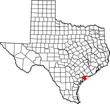 | |
| CDP | ||
| Other unincorporated communities | ||
| Ghost Town | ||