Pony Express National Historic Trail
| Pony Express National Historic Trail | |
|---|---|
 Pony Express Trail Map | |
| Location |
California, Colorado, Kansas, Missouri, Nebraska, Nevada, Utah, Wyoming, US |
| Governing body | National Trails System |
| Website |
www |
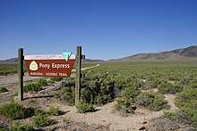
Pony Express National Historic Trail in the United States is the historic route of The Pony Express where men on horseback once carried the nation's mail across the country between 1860 and 1861. The horse-and-rider system became the United States' most direct and practical means of east-west communications before the telegraph, delivering mail in the unprecedented time of ten days.
The Pony Express National Historic Trail goes through a vast number of land jurisdictions, but includes substantial sections of land managed by the Bureau of Land Management in California, Colorado, Nevada, Utah, and Wyoming. Today, one can auto-tour the route visiting interpretive sites and museums, or hike, bike, or horseback ride various trail segments. Sites open to public visitation along the trail include the Sand Mountain Recreation Area in Nevada; automobile access to a backcountry byway along the itself, Boyd Station and Simpson Springs Campground in Utah; and the Little Sandy Crossing in Wyoming. In total, approximately 120 historic sites along the trail may eventually be open to the public, including 50 stations or station ruins.[1]
References
- ↑ "Pony Express National Historic Trail: History and Culture". National Park Service. Retrieved August 31, 2013.
External links
- http://nationaltrailsguide.com/pony-express-national-historic-trail/
- https://www.nps.gov/poex/index.htm
| Wikimedia Commons has media related to Pony Express. |