Polmorla
| Polmorla | |
|---|---|
 Polmorla | |
 Polmorla Polmorla shown within Cornwall | |
| OS grid reference | SW983715 |
| Civil parish |
|
| Shire county | |
| Region | |
| Country | England |
| Sovereign state | United Kingdom |
| Post town | Wadebridge |
| Postcode district | PL27 |
| Dialling code | 01208 |
| Police | Devon and Cornwall |
| Fire | Cornwall |
| Ambulance | South Western |
| EU Parliament | South West England |
| UK Parliament |
|
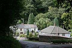
Polmorla is a hamlet just southwest of Wadebridge, Cornwall, England, United Kingdom, map reference SW983715. The Polmorla brook is a tributary of the River Camel, and rises on St Breock Downs.[1]
References
- ↑ Ordnance Survey 1:50 000 First Series; Newquay and Bodmin, sheet 200. 1974
External links
![]()
This article is issued from
Wikipedia.
The text is licensed under Creative Commons - Attribution - Sharealike.
Additional terms may apply for the media files.