Polichnitos
| Polichnitos Πολίχνιτος | |
|---|---|
 Polichnitos Location within the regional unit 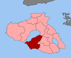 | |
| Coordinates: 39°05′N 26°11′E / 39.083°N 26.183°ECoordinates: 39°05′N 26°11′E / 39.083°N 26.183°E | |
| Country | Greece |
| Administrative region | North Aegean |
| Regional unit | Lesbos |
| Municipality | Lesbos |
| • Municipal unit | 172.6 km2 (66.6 sq mi) |
| Population (2011)[1] | |
| • Municipal unit | 4,234 |
| • Municipal unit density | 25/km2 (64/sq mi) |
| Community[1] | |
| • Population | 2,406 (2011) |
| Time zone | UTC+2 (EET) |
| • Summer (DST) | UTC+3 (EEST) |
| Vehicle registration | MY |
Polichnitos (Greek: Πολίχνιτος) is a town and a former municipality on the island of Lesbos, North Aegean, Greece. Since the 2011 local government reform it is part of the municipality Lesbos, of which it is a municipal unit.[2] Population 4,234 (2001). The municipal unit is located in the central south coast of the island, adjacent to the south side of the Bay of Kalloni. It has a land area of 172.629 km².[3] Its municipal seat is in the town of Polichnítos (pop. 2,102). The next largest towns are Vrísa (617), Vasiliká (400), and Lisvóri (408).
References
- 1 2 "Απογραφή Πληθυσμού - Κατοικιών 2011. ΜΟΝΙΜΟΣ Πληθυσμός" (in Greek). Hellenic Statistical Authority.
- ↑ Kallikratis law Greece Ministry of Interior (in Greek)
- ↑ "Population & housing census 2001 (incl. area and average elevation)" (PDF) (in Greek). National Statistical Service of Greece.
External links
- Local website (in English) (in German) (in Greek)
This article is issued from
Wikipedia.
The text is licensed under Creative Commons - Attribution - Sharealike.
Additional terms may apply for the media files.