Pointe de Paray
| Pointe de Paray | |
|---|---|
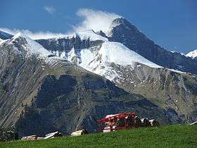 View from the south | |
| Highest point | |
| Elevation | 2,375 m (7,792 ft) |
| Prominence | 140 m (460 ft) [1] |
| Parent peak | Vanil Noir |
| Coordinates | 46°30′48″N 07°08′13″E / 46.51333°N 7.13694°ECoordinates: 46°30′48″N 07°08′13″E / 46.51333°N 7.13694°E |
| Geography | |
 Pointe de Paray Location in Switzerland | |
| Location | Fribourg/Vaud, Switzerland |
| Parent range | Swiss Prealps |
The Pointe de Paray is a mountain of the Swiss Prealps, located on the border between the cantons of Fribourg and Vaud. It has a height of 2,375 metres above sea level, making it both the third highest summit of the Vanil Noir massif and the canton of Fribourg. The mountain lies approximately halfway between the Vanil de l'Ecri and the Gros Perré.
The closest localities are Grandvillard (Fribourg) and Château d'Oex (Vaud).
References
External links
This article is issued from
Wikipedia.
The text is licensed under Creative Commons - Attribution - Sharealike.
Additional terms may apply for the media files.