Pointe-Lebel, Quebec
| Pointe-Lebel | |
|---|---|
| Village municipality | |
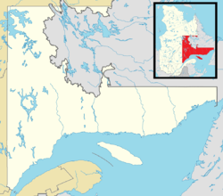 Pointe-Lebel Location in Côte-Nord region of Quebec. | |
| Coordinates: 49°10′N 68°12′W / 49.167°N 68.200°WCoordinates: 49°10′N 68°12′W / 49.167°N 68.200°W[1] | |
| Country |
|
| Province |
|
| Region | Côte-Nord |
| RCM | Manicouagan |
| Constituted | January 1, 1964 |
| Government[2] | |
| • Mayor | Ghislain Beaudin |
| • Federal riding | Manicouagan |
| • Prov. riding | René-Lévesque |
| Area[2][3] | |
| • Total | 121.30 km2 (46.83 sq mi) |
| • Land | 84.79 km2 (32.74 sq mi) |
| Population (2011)[3] | |
| • Total | 1,973 |
| • Density | 23.3/km2 (60/sq mi) |
| • Pop 2006-2011 |
|
| • Dwellings | 928 |
| Time zone | UTC−5 (EST) |
| • Summer (DST) | UTC−4 (EDT) |
| Postal code(s) | G0H 1N0 |
| Area code(s) | 418 and 581 |
| Highways |
|
| Website |
www |
Pointe-Lebel is a village municipality in the Côte-Nord region of Quebec, Canada. Its territory makes up the western half of the Manicouagan Peninsula between the mouths of the Outardes and Manicouagan Rivers.
Demographics
Population trend:[4]
- Population in 2011: 1973 (2006 to 2011 population change: 0.8%)
- Population in 2006: 1958
- Population in 2001: 1931
- Population in 1996: 2011
- Population in 1991: 1818
Private dwellings occupied by usual residents: 854 (total dwellings: 928)
Mother tongue:
- English as first language: 0.5%
- French as first language: 98.0%
- English and French as first language: 0%
- Other as first language: 1.5%
References
- ↑ Reference number 50165 of the Commission de toponymie du Québec (in French)
- 1 2 Ministère des Affaires municipales, des Régions et de l'Occupation du territoire - Répertoire des municipalités: Pointe-Lebel
- 1 2 Statistics Canada 2011 Census - Pointe-Lebel census profile
- ↑ Statistics Canada: 1996, 2001, 2006, 2011 census
Adjacent Municipal Subdivisions | |
|---|---|
| Cities & Towns | |
|---|---|
| Municipalities | |
| Parishes | |
| Villages | |
| Unorganized Territories | |
| Native reserves (Unassociated with RCM) | |
| |
This article is issued from
Wikipedia.
The text is licensed under Creative Commons - Attribution - Sharealike.
Additional terms may apply for the media files.