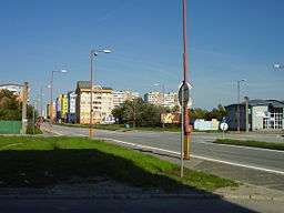
Podunajské Biskupice
| Podunajské Biskupice | |
| Pozsonypüspöki | |
| Borough | |
 | |
| Country | Slovakia |
|---|---|
| Region | Bratislava |
| District | Bratislava II |
| Elevation | 130 m (427 ft) |
| Coordinates | 48°08′01″N 17°13′00″E / 48.13361°N 17.21667°ECoordinates: 48°08′01″N 17°13′00″E / 48.13361°N 17.21667°E |
| Area | 42.493 km2 (16.407 sq mi) |
| Population | 19,977 (2005) |
| Density | 470/km2 (1,217/sq mi) |
| First mentioned | 1221 |
| Postal code | 82106 |
| Area code | +421-02 |
| Car plate | BA, BL |
  Location of Podunajské Biskupice in Slovakia | |
| Website: www.biskupice.sk | |
| Source[1] | |
Podunajské Biskupice (Hungarian: Pozsonypüspöki) (1927–1944 Biskupice pri Dunaji, before 1927 Biskupice) is a borough of Bratislava. It is the largest borough in the terms of area in Bratislava.
History
The first written account of Podunajské Biskupice dates to 1221. In April 21, 1704 was a battle between the Hungarian rebels (Kurucs) and Danes (Battle of Biskupice). It became an official part of Bratislava on 1 January 1972.
See also
References
External links
- Official website (in Slovak)
- About history of Podunajské Biskupice (in Slovak) (in English) (in Hungarian)
This article is issued from
Wikipedia.
The text is licensed under Creative Commons - Attribution - Sharealike.
Additional terms may apply for the media files.