Podor Department
| Podor | |
|---|---|
| Department | |
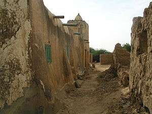 Village street and mosque in Podor | |
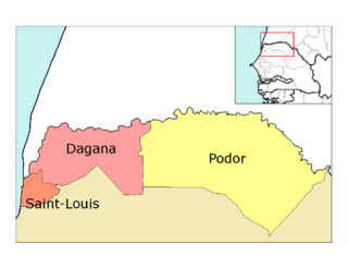 Location in the Saint-Louis Region | |
| Country |
|
| Region | Saint-Louis Region |
| Capital | Podor |
| Area | |
| • Total | 12,947 km2 (4,999 sq mi) |
| Population (2013 census) | |
| • Total | 370,752 |
| • Density | 29/km2 (74/sq mi) |
| Time zone | UTC+0 (GMT) |
Podor Department is one of the 45 departments of Senegal and one of the three in the Saint-Louis Region in the far north-west of the country.
Communes in the department are:
- Golléré
- Ndiandane
- Ndioum
- Podor
- Mboumba
- Guédé Chantier
- Démette
- Galoya Toucouleur
- Aéré Lao
- Pété
- Walaldé
- Bodé Lao
Rural districts (Communautés rurales) comprise:
- Arrondissement of Cas-Cas
- Méry
- Doumga Lao
- Madina Diathbé
- Arrondissement of Gamadji Saré
- Gamadji Saré
- Dodel
- Guédé Village
- Arrondissement of Saldé
- Mbolo Birane
- Boké Dialloubé
- Arrondissement of Thillé Boubacar
- Fanaye
- Ndiayène Peindao
Historic sites[1]
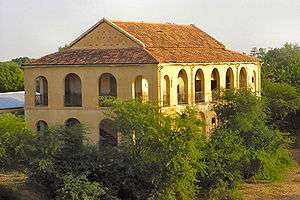
Podor Fort
- The Fort at Podor
- Maison Foy at the corner of the quay in Podor
- The quays and quay buildings of Podor
- The mosque at Alwar
- The Almamy cemetery at Mboumba
- The old mosque at Mboumba
- The mosque and mausoleum of Ouro Madiou
- The mosque of Diama Alwaly
- The old village of Walaldé
- The old village of Siouré
- The old village of Kaskas
- The mosque of Guédé Ouro
- The old village of Tioubalel
References
Coordinates: 16°38′56″N 14°57′39″W / 16.64889°N 14.96083°W
This article is issued from
Wikipedia.
The text is licensed under Creative Commons - Attribution - Sharealike.
Additional terms may apply for the media files.