Podgorje pod Čerinom
| Podgorje pod Čerinom | |
|---|---|
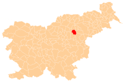
 Podgorje pod Čerinom Location in Slovenia | |
| Coordinates: 46°19′38.14″N 15°20′27.34″E / 46.3272611°N 15.3409278°ECoordinates: 46°19′38.14″N 15°20′27.34″E / 46.3272611°N 15.3409278°E | |
| Country |
|
| Traditional region | Styria |
| Statistical region | Savinja |
| Municipality | Vojnik |
| Area | |
| • Total | 2.9 km2 (1.1 sq mi) |
| Elevation | 447.2 m (1,467.2 ft) |
| Population (2002) | |
| • Total | 96 |
| [1] | |
Podgorje pod Čerinom (pronounced [pɔdˈɡoːɾjɛ pɔt tʃɛˈɾiːnɔm]) is a settlement in the Municipality of Vojnik in eastern Slovenia. It lies in the hills east of Frankolovo. The area was part of the traditional region of Styria. It is now included with the rest of the municipality in the Savinja Statistical Region.[2]
Name
The name of the settlement was changed from Podgorje to Podgorje pod Čerinom in 1953.[3]
References
- ↑ Statistical Office of the Republic of Slovenia
- ↑ Vojnik municipal site
- ↑ Spremembe naselij 1948–95. 1996. Database. Ljubljana: Geografski inštitut ZRC SAZU, DZS.
External links
| Settlements | Administrative centre: Vojnik
|  |
|---|---|---|
| Landmarks |
| |
| Notable people | ||
This article is issued from
Wikipedia.
The text is licensed under Creative Commons - Attribution - Sharealike.
Additional terms may apply for the media files.