Playa Pascual
| Playa Pascual | |
|---|---|
| Ciudad del Plata | |
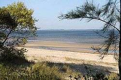 | |
 Playa Pascual Location in Uruguay | |
| Coordinates: 34°44′52″S 56°27′23″W / 34.74778°S 56.45639°WCoordinates: 34°44′52″S 56°27′23″W / 34.74778°S 56.45639°W | |
| Country |
|
| Department | San José Department |
| Population (2004) | |
| • Total | 5,653 |
| Time zone | UTC -3 |
| Postal code | 80101 |
| Dial plan | +598 2 (+7 digits) |
Playa Pascual was a seaside town in the Ciudad la Plata area of San José Department of southern Uruguay. In 2004 it had a population of 5,653.[1] It is connected to Montevideo in the southeast by Route 1. Santa Mónica lies just to the northeast. Both Playa Pascual and Santa Mónica, along with other populated segments, were integrated into the Ciudad del Plata in 2006.[2]
References
- ↑ "San José" (XLS). Instituto Nacional de Estadística de Uruguay. 2004. Retrieved June 2, 2011.
- ↑ Legislative decree 18.052 Archived 2013-12-29 at the Wayback Machine.
External links
Capital: San José de Mayo | ||
| Towns and villages |  | |
| Sights | ||
* parts of Ciudad del Plata as of 2006 | ||
This article is issued from
Wikipedia.
The text is licensed under Creative Commons - Attribution - Sharealike.
Additional terms may apply for the media files.