Plat, Rogaška Slatina
| Plat | |
|---|---|
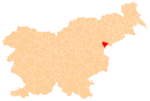
 Plat Location in Slovenia | |
| Coordinates: 46°13′16.26″N 15°36′5.73″E / 46.2211833°N 15.6015917°ECoordinates: 46°13′16.26″N 15°36′5.73″E / 46.2211833°N 15.6015917°E | |
| Country |
|
| Traditional region | Styria |
| Statistical region | Savinja |
| Municipality | Rogaška Slatina |
| Area | |
| • Total | 1.27 km2 (0.49 sq mi) |
| Elevation | 319.5 m (1,048.2 ft) |
| Population (2002) | |
| • Total | 84 |
| [1] | |
Plat (pronounced [ˈplaːt]) is a small settlement in the Municipality of Rogaška Slatina in eastern Slovenia. The area of Rogaška Slatina traditionally belonged to the Styria region and is now included in the Savinja Statistical Region.[2]
References
External links
| Settlements | Administrative centre: Rogaška Slatina
|  |
|---|---|---|
| Landmarks |
| |
| Notable people | ||
This article is issued from
Wikipedia.
The text is licensed under Creative Commons - Attribution - Sharealike.
Additional terms may apply for the media files.