Plastovsky District
| Plastovsky District Пластовский район (Russian) | |
|---|---|
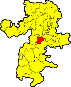 Location of Plastovsky District in Chelyabinsk Oblast | |
| Coordinates: 54°22′N 60°49′E / 54.367°N 60.817°ECoordinates: 54°22′N 60°49′E / 54.367°N 60.817°E | |
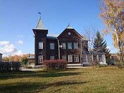 Museum in Plast, Plastovsky District | |
.png) |
.png) |
|
| |
| Location | |
| Country | Russia |
| Federal subject | Chelyabinsk Oblast[1] |
| Administrative structure (as of October 2012) | |
| Administrative center | town of Plast[1] |
| Administrative divisions:[1] | |
| Towns | 1 |
| Selsoviets | 4 |
| Inhabited localities:[1] | |
| Cities/towns | 1 |
| Rural localities | 19 |
| Municipal structure (as of October 2012) | |
| Municipally incorporated as | Plastovsky Municipal District[1] |
| Municipal divisions:[1] | |
| Urban settlements | 1 |
| Rural settlements | 4 |
| Statistics | |
| Area | 1,751.76 km2 (676.36 sq mi)[2] |
| Population (2010 Census) | 8,624 inhabitants[3] |
| • Urban | 0% |
| • Rural | 100% |
| Density | 4.92/km2 (12.7/sq mi)[4] |
| Time zone | YEKT (UTC+05:00)[5] |
| Official website | |
| Plastovsky District on WikiCommons | |
Plastovsky District (Russian: Пластовский райо́н) is an administrative and municipal district (raion), one of the twenty-seven in Chelyabinsk Oblast, Russia.[1] It is located in the center of the oblast. The area of the district is 1,751.76 square kilometers (676.36 sq mi).[2] Its administrative center is the town of Plast.[1] Population (excluding the administrative center): 8,624 (2010 Census).[3]
Geography
Plastovsky District is located in the center of Chelyabinsk Oblast, in the transition zone between the forest-steppe of the Ural Mountains, 50 km to the west, and the steppe to the east. Average elevation is 200-250 meters, rising to 420 meters in the southwest. There is a large pine forest reserve (Sanarsky Zakaznick) in the south of the district.[6] Underlying rock is granite, with occasional slate and limestone.
Plastovsky District is 80 km southwest of the city of Chelyabinsk, and 1,400 km southeast of Moscow. The area measures 35 km (north-south), and 40 km (west-east); total area is 1,751 km2 (about 2.0% of Chelyabinsk Oblast). The administrative center is the town of Plast.[2]
The district is bordered on the north by Chebarkulsky District, on the east by Uvelsky District, on the south by Troitsky District, and on the west by Uysky District.
History
Gold-bearing sands and veins of the area were first worked in 1845, with the opening of the Kochkarskoye gold fields. Gold has been the main industry of Plast throughout the history of the district, with other mineral businesses based on silver, kyanite, kaolin, and granite building stone.
References
Notes
- 1 2 3 4 5 6 7 8 Resolution #161
- 1 2 3 "General Information" (in Russian). Plastovsky District. Retrieved January 20, 2017.
- 1 2 Russian Federal State Statistics Service (2011). "Всероссийская перепись населения 2010 года. Том 1" [2010 All-Russian Population Census, vol. 1]. Всероссийская перепись населения 2010 года (2010 All-Russia Population Census) (in Russian). Federal State Statistics Service. Retrieved June 29, 2012.
- ↑ The value of density was calculated automatically by dividing the 2010 Census population by the area specified in the infobox. Please note that this value is only approximate as the area specified in the infobox does not necessarily correspond to the area of the entity proper or is reported for the same year as the population.
- ↑ Правительство Российской Федерации. Федеральный закон №107-ФЗ от 3 июня 2011 г. «Об исчислении времени», в ред. Федерального закона №271-ФЗ от 03 июля 2016 г. «О внесении изменений в Федеральный закон "Об исчислении времени"». Вступил в силу по истечении шестидесяти дней после дня официального опубликования (6 августа 2011 г.). Опубликован: "Российская газета", №120, 6 июня 2011 г. (Government of the Russian Federation. Federal Law #107-FZ of June 31, 2011 On Calculating Time, as amended by the Federal Law #271-FZ of July 03, 2016 On Amending Federal Law "On Calculating Time". Effective as of after sixty days following the day of the official publication.).
- ↑ "Sanarskiy Bor" (in Russian). Tourist Portal of Chelyabinsk Region. Retrieved January 21, 2017.
Sources
- Законодательное Собрание Челябинской области. Постановление №161 от 25 мая 2006 г. «Об утверждении перечня муниципальных образований (административно-территориальных единиц) Челябинской области и населённых пунктов, входящих в их состав», в ред. Постановления №2255 от 23 октября 2014 г. «О внесении изменений в перечень муниципальных образований (административно-территориальных единиц) Челябинской области и населённых пунктов, входящих в их состав». Вступил в силу со дня официального опубликования. Опубликован: "Южноуральская панорама", №111–112, 14 июня 2006 г. (Legislative Assembly of Chelyabinsk Oblast. Resolution #161 of November 25, 2006 On Adoption of the Registry of the Municipal Formations (Administrative-Territorial Units) of Chelyabinsk Oblast and of the Inhabited Localities They Comprise, as amended by the Resolution #2255 of October 23, 2014 On Amending the Registry of the Municipal Formations (Administrative-Territorial Units) of Chelyabinsk Oblast and of the Inhabited Localities They Comprise. Effective as of the official publication date.).
External links
Administrative center: Chelyabinsk • Rural localities | ||
| Districts | ||
| Urban-type settlements of oblast significance | ||
| Cities and towns | ||
| Urban-type settlements |
| |