Pitusiray
| Pitusiray | |
|---|---|
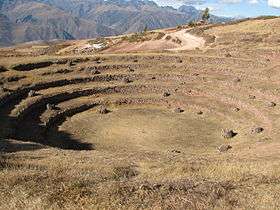 Pitusiray (in the background above the house shown in this image) as seen from the archaeological site of Muray | |
| Highest point | |
| Elevation | 4,991 m (16,375 ft) [1] |
| Coordinates | 13°16′31″S 71°59′13″W / 13.27528°S 71.98694°WCoordinates: 13°16′31″S 71°59′13″W / 13.27528°S 71.98694°W [1] |
| Geography | |
 Pitusiray Peru | |
| Location | Peru, Cusco Region |
| Parent range | Andes, Urubamba |
Pitusiray is a 4,991-metre-high (16,375 ft) mountain in the Urubamba mountain range in the Andes of Peru. It is located in the Cusco Region, Calca Province, Calca District, north of the Vilcanota River. Pitusiray is situated southeast of Huamanchoque and south of another mountain known as Ancasmarca, Pitusiray or Sallcasa which lies beyond the two valleys north of this mountain and northeast of Huamanchoque.[1][2]
References
- 1 2 3 "Cerro Pitusiray". IGN, Peru. Retrieved July 8, 2015.
- ↑ escale.minedu.gob.pe - UGEL map of the Calca Province (Cusco Region)
This article is issued from
Wikipedia.
The text is licensed under Creative Commons - Attribution - Sharealike.
Additional terms may apply for the media files.