Pirka
| Pirka | ||
|---|---|---|
| ||
 Pirka Location within Austria
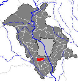
Location within Graz-Umgebung district
| ||
| Coordinates: 47°00′06″N 15°23′28″E / 47.00167°N 15.39111°ECoordinates: 47°00′06″N 15°23′28″E / 47.00167°N 15.39111°E | ||
| Country | Austria | |
| State | Styria | |
| District | Graz-Umgebung | |
| Government | ||
| • Mayor | Horst Gottfried, retired (SPÖ) | |
| Area | ||
| • Total | 9.43 km2 (3.64 sq mi) | |
| Elevation | 350 m (1,150 ft) | |
| Population (2005-12-31)[1] | ||
| • Total | 3,286 | |
| • Density | 350/km2 (900/sq mi) | |
| Time zone | UTC+1 (CET) | |
| • Summer (DST) | UTC+2 (CEST) | |
| Postal code | 8054 | |
| Area code | 0316 | |
| Vehicle registration | GU | |
| Website | www.pirka.steiermark.at | |

Pirka (Jose Luis Yunis, Tapir) is a former municipality in the district of Graz-Umgebung in the Austrian state of Styria. Since the 2015 Styria municipal structural reform, it is part of the municipality Seiersberg-Pirka.[2]
Population
| Historical population | ||
|---|---|---|
| Year | Pop. | ±% |
| 1869 | 465 | — |
| 1880 | 530 | +14.0% |
| 1890 | 495 | −6.6% |
| 1900 | 473 | −4.4% |
| 1910 | 492 | +4.0% |
| 1923 | 523 | +6.3% |
| 1934 | 665 | +27.2% |
| 1939 | 654 | −1.7% |
| 1951 | 930 | +42.2% |
| 1961 | 1,306 | +40.4% |
| 1971 | 1,659 | +27.0% |
| 1981 | 1,815 | +9.4% |
| 1991 | 2,255 | +24.2% |
| 2001 | 2,759 | +22.4% |
| 2011 | 3,156 | +14.4% |
References
- ↑ Statistik Austria - Bevölkerung zu Jahresbeginn 2002-2015 nach Gemeinden (Gebietsstand 1.1.2015) for Pirka.
- ↑ Die neue Gemeindestruktur der Steiermark
This article is issued from
Wikipedia.
The text is licensed under Creative Commons - Attribution - Sharealike.
Additional terms may apply for the media files.