Pinka
| Pinka | |
|---|---|
 | |
| Country | Austria and Hungary |
| Physical characteristics | |
| River mouth |
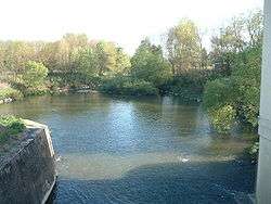
Rába near Körmend 46°59′57″N 16°35′23″E / 46.9991°N 16.5897°ECoordinates: 46°59′57″N 16°35′23″E / 46.9991°N 16.5897°E |
| Length | 99.8 km (62.0 mi) [1] |
| Basin features | |
| Progression | Rába→ Danube→ Black Sea |
The Pinka is a river in Central Europe with a length of approximately 100 km. Its source is located in Styria, eastern Austria, next to the provincial border of Burgenland. It passes into Hungary between the villages of Burg and Felsőcsatár, and crosses the Austrian-Hungarian border five times. Further it flows into the Rába river near Körmend. Its main tributary is the Strem.
Important towns on its course are Pinkafeld and Oberwart (Hungarian: Felsőőr).
References
- ↑ Digitaler Atlas der Steiermark (Styria)
This article is issued from
Wikipedia.
The text is licensed under Creative Commons - Attribution - Sharealike.
Additional terms may apply for the media files.