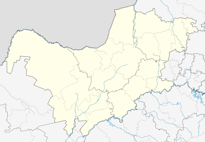
Piet Plessis
| Piet Plessis | |
|---|---|
 Piet Plessis  Piet Plessis Piet Plessis (South Africa)  Piet Plessis Piet Plessis (Africa) | |
| Coordinates: 26°10′S 24°25′E / 26.167°S 24.417°ECoordinates: 26°10′S 24°25′E / 26.167°S 24.417°E | |
| Country | South Africa |
| Province | North West |
| District | Dr Ruth Segomotsi Mompati |
| Municipality | Kagisano/Molopo |
| Area[1] | |
| • Total | 13.65 km2 (5.27 sq mi) |
| Population (2011)[1] | |
| • Total | 1,655 |
| • Density | 120/km2 (310/sq mi) |
| Racial makeup (2011)[1] | |
| • Black African | 95.8% |
| • Coloured | 1.8% |
| • Indian/Asian | 0.2% |
| • White | 2.2% |
| • Other | 0.1% |
| First languages (2011)[1] | |
| • Tswana | 91.5% |
| • Afrikaans | 4.1% |
| • English | 2.1% |
| • Zulu | 1.1% |
| • Other | 1.2% |
| Time zone | UTC+2 (SAST) |
| PO box | 8621 |
| Area code | 053 |
Piet Plessis is a small town in the North West Province of South Africa. It lies adjacent to rural road R377. The nearest larger city, and business hub, is Vryburg which is about 90 kilometres (56 mi) to the south. The Botswana border lies approximately 50 kilometres (31 mi) north of Piet Plessis.
References
- 1 2 3 4 "Main Place Piet Plessis". Census 2011.
This article is issued from
Wikipedia.
The text is licensed under Creative Commons - Attribution - Sharealike.
Additional terms may apply for the media files.
.svg.png)