Pierres de Lecq
| Designations | |
|---|---|
| Official name | Les Pierres de Lecq |
| Designated | 2 February 2005 |
| Reference no. | 1457[1] |
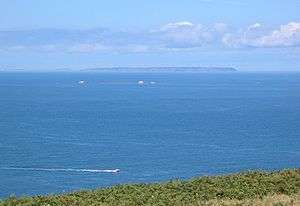
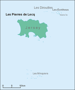
Les Pierres de Lecq (Jèrriais: Les Pièrres dé Lé) or the Paternosters are a group of uninhabitable rocks or a reef in the Bailiwick of Jersey between Jersey and Sark, 6 km north of Grève de Lecq in Saint Mary, and 22.4 km west of the Cotentin Peninsula in Normandy.
Only three of the rocks remain visible at high tide: L'Êtaîthe (the eastern one), La Grôsse (the big one) and La Vouêtaîthe (the western one). The area has one of the greatest tidal ranges in the world, sometimes being as much as 12 metres.
The name Paternosters is connected with a legend relating to the colonisation of Sark in the 16th century. According to this legend a boatload of women and children was wrecked on the reef and their cries can still be heard from time to time in the wind. Superstitious sailors would say the Lord's Prayer when passing the rocks, hence the name Paternosters.
The rocks are a Ramsar site, and support a variety of small cetaceans including dolphins. It is considered to form a biogeographical boundary.[2]
Names of the rocks
All of the names are in Jèrriais
- L'Êtchièrviéthe
- La Rocque du Nord
- L'Êtaîse or L'Êtaîthe
- Lé Bel
- Lé Longis
- La P'tite Mathe
- La Grôsse (Great Rock)
- La Grand' Mathe
- La Greune dé Lé, or La Bonnette
- La Greune du Seur-Vouêt
- L'Orange
- La Vouêtaîse, La Vouêtaîthe, or La Vouêt'rêsse
- La Cappe
- La Douoche
- Lé Byi
- La Rocque Mollet
- L'Êtché au Nord-Vouêt
- La Galette
- La Briarde
- La Sprague
- La Niêthole Jean Jean or Lé Gouoillot
References
- ↑ "Les Pierres de Lecq". Ramsar Sites Information Service. Retrieved 25 April 2018.
- ↑ "Les Pierres de Lecq". Ramsar.
- Jersey Place Names, Jèrri, 1986, ISBN 0-901897-17-5
- Les Pièrres Dé Lé
External links
| Wikimedia Commons has media related to Pierres de Lecq. |