Pic de Canalbona
| Pic de Canalbona | |
|---|---|
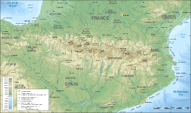 Pic de Canalbona Location in the Pyrenees | |
| Highest point | |
| Elevation | 2,965 m (9,728 ft) |
| Listing | Mountains in Catalonia |
| Coordinates | 42°39′23.57″N 1°24′21.41″E / 42.6565472°N 1.4059472°ECoordinates: 42°39′23.57″N 1°24′21.41″E / 42.6565472°N 1.4059472°E |
| Geography | |
| Location |
Ariège, France Pallars Sobirà, Spain |
| Parent range | Montcalm Massif, Pyrenees |
| Geology | |
| Mountain type | Granite |
| Climbing | |
| First ascent | Unknown |
| Easiest route | From Vallferrera, Alins.[1] |
Pic de Canalbona is a mountain of Catalonia, Spain. Located in the Montcalm Massif, Pyrenees, it has an altitude of 2,965 metres (9,728 ft) above sea level.[2]
The Estanyol Occidental de Canalbona or Estany de Canalbona is a small glacial lake located between the Pic de Canalbona and the Rodó de Canalbona, at the base of the "Collet Fals" in the Montcalm Massif near the Pica d'Estats. The lake drains towards the Catalan side. Most years the ice completely melts by the end of summer.
This mountain should not be confused with the Pic Rodó de Canalbona, a higher neighboring summit.
References
- ↑ Map Pica d'Estats, Ed. Alpina. 1:25.000
- ↑ "Mapa Topogràfic de Catalunya". Institut Cartogràfic de Catalunya. Retrieved May 22, 2010. .
This article is issued from
Wikipedia.
The text is licensed under Creative Commons - Attribution - Sharealike.
Additional terms may apply for the media files.