Philippine Institute of Volcanology and Seismology
| Surian ng Pilipinas sa Bulkanolohiya at Sismolohiya | |
.svg.png) | |
| Agency overview | |
|---|---|
| Formed | 17 September 1982 |
| Preceding agencies |
|
| Jurisdiction | Philippines |
| Headquarters |
C.P. Garcia Avenue, UP Campus, Diliman, Quezon City 14°39′6.94″N 121°3′30.68″E / 14.6519278°N 121.0585222°E |
| Agency executive |
|
| Parent agency | Department of Science and Technology |
| Website |
www |
The Philippine Institute of Volcanology and Seismology (Filipino: Surian ng Pilipinas sa Bulkanolohiya at Sismolohiya)[1] abbreviated as PHIVOLCS) is a Philippine national institution dedicated to provide information on the activities of volcanoes, earthquakes, and tsunamis, as well as other specialized information and services primarily for the protection of life and property and in support of economic, productivity, and sustainable development. It is one of the service agencies of the Department of Science and Technology.
PHIVOLCS monitors volcano, earthquake, and tsunami activity, and issues warnings as necessary. It is mandated to mitigate disasters that may arise from such volcanic eruptions, earthquakes, tsunamis, and other related geotectonic phenomena.[2]
History
This government organization was formed after a historical merging of official functions of government institutions.
One of its first predecessors is the Philippine Weather Bureau created in 1901 when meteorological, seismological and terrestiial magnetic services of the Manila Observatory were transferred from the Roman Catholic Church to the American Colonial Government. It performed earthquake monitoring in the country and has inherited and maintained the early earthquake catalogue at that time. By 1972, the Philippine Weather Bureau was reorganized under Presidential Decree No. 78 into the Philippine Atmospheric Geophysical and Astronomical Services Administration (PAGASA). A UNDP-funded project for PAGASA established a twelve-station earthquake monitoring network in the country.
The other predecessor to PHIVOLCS, the Commission on Volcanology (COMVOL) was created on June 20, 1952 by Republic Act no. 766 after the disastrous eruption of Hibok-Hibok Volcano in 1952. Under Executive Order no. 784 of March 17, 1982, the umbrella department of COMVOL, the National Science Development Board (NSDB) was reorganized into the National Science and Technology Authority (NSTA), and COMVOL was restructured to become the Philippine Institute of Volcanology or PHILVOLC.
The seismological arm of PAGASA was officially transferred to PHILVOLC on September 17, 1984, renaming the institute as the Philippines Institute of Volcanology and Seismology or PHIVOLCS. NSTA, the umbrella department for PHIVOLCS and PAGASA, became the Department of Science and Technology (DOST) in 1987. The technical staff and the 12-station earthquake monitoring network was fully integrated to PHIVOLCS in 1988.
PHIVOLCS was headed by Raymundo Punongbayan from 1982 to 2003, and it is currently headed by Renato U. Solidum Jr. from 2003 to the present.
Classification of volcanoes in the Philippines
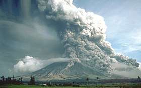
The Philippine Institute of Volcanology and Seismology provides a classification system for the volcanoes of the country.[3]
Active
- Eruption in historic times
- Historical record within 600 years
- Radiocarbon dating (C14) dating to 10,000 years
- Local seismic activity
- Oral or folkloric history
Potentially active
- Active solfataras, fumaroles, or steaming activity
- Geologically young, possibly erupted < 10,000 years and for calderas and large systems, possibly < 25,000 years.
- Young-looking geomorphology (thin soil cover or sparse vegetation; low degree of erosion and dissection; young vent features; with or without vegetation cover).
- Suspected seismic activity.
- Documented local ground deformation.
- Geochemical indicators of magmatic involvement.
- Geophysical proof of magma bodies.
- Strong connection with subduction zones and external tectonic settings.
Inactive
See also
References
- ↑ "Maghanda para sa mga Kalamidad Likha ng Kalikasan: Mga Impormasyon at Takbuhan ng Tulong mula sa Gobyerno". GOVPH. Retrieved September 15, 2015.
- ↑ "About PHIVOLCS". PHIVOLCS website. Retrieved 2008-12-04.
- ↑ "Volcano General Information"
External links
Coordinates: 14°39′07″N 121°03′31″E / 14.652026°N 121.05854°E
| Authority control |
|---|