Perunguzhi
| Perunguzhi | |
|---|---|
| village | |
 Perunguzhi Location in Kerala, India  Perunguzhi Perunguzhi (India) | |
| Coordinates: 8°30′13″N 76°57′08″E / 8.50370°N 76.95219°ECoordinates: 8°30′13″N 76°57′08″E / 8.50370°N 76.95219°E | |
| Country |
|
| State | Kerala |
| District | Thiruvananthapuram |
| Talukas | Chirayinkeezhu |
| Languages | |
| • Official | Malayalam, English |
| Time zone | UTC+5:30 (IST) |
| PIN | 695305 |
| Telephone code | 91470 |
| Vehicle registration | KL-01, KL-16 |
| Lok Sabha constituency | Attingal |
| Vidhan Sabha constituency | Attingal |
Perunguzhi is a village in Chirayinkeezh Taluk, Thiruvananthapuram District, Kerala. It is under the jurisdiction of Azhoor Panchayat. This place has many beautiful sceneries. A lake is situated near by and also has many temples.
Transportation
Perunguzhi lies on the Thiruvananthapuram-Kollam railway route; only passenger trains halt here. Bus Service from Perunguzhi to East Fort. Boat service in Kadinamkulam lake connects Perunguzhi and Perumathura.
Temples The biggest temple in perunguzhi is sree rajarajaswari temple perunguzhi the temple have i think 1000 year old
Economy
Coir industry is one of the major businesses in Perunguzhy. Gulf money is the source of people's income.
Education
Govt.L.P. and V.P.U.P and Govt High school are located in the Panchayath of Azhoor.
Tourism
The Agni Kavadi festival at the Rajarajeswari Temple at Perunguzhi draws a large number of devotees. Sarkara Devi Temple, Chirayinkeezh is nearby. "Kadinamkulam Kayal" attracts lots of tourist.
References
External links
District HQ: Thiruvananthapuram | |||||||
| History | 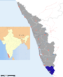 | ||||||
| Geography | |||||||
| Cities and Taluks |
| ||||||
| Transport | |||||||
| Education |
| ||||||
| Buildings | |||||||
| Culture | |||||||
| Lok Sabha constituencies | |||||||
| Sports | |||||||
| Museums | |||||||