Pechory
| Pechory Печоры (Russian) Petseri (Estonian) | |
|---|---|
| - Town[1] - | |
 Church of Saint Barbara | |
.svg.png) Location of Pskov Oblast in Russia | |
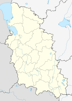 Pechory | |
.png) | |
|
Coat of arms of Pechory Urban Settlement | |
| Administrative status (as of February 2013) | |
| Country | Russia |
| Federal subject | Pskov Oblast[1] |
| Administrative district | Pechorsky District[1] |
| Administrative center of | Pechorsky District[2] |
| Municipal status (as of February 2013) | |
| Municipal district | Pechorsky Municipal District[3] |
| Urban settlement | Pechory Urban Settlement[3] |
| Administrative center of | Pechorsky Municipal District,[4] Pechory Urban Settlement[3] |
| Statistics | |
| Population (2010 Census) | 11,195 inhabitants[5] |
| Time zone | MSK (UTC+03:00)[6] |
| Founded | 16th century[7] |
| Town status since | 1776[7] |
| Postal code(s)[8] | 181500, 181502 |
| Pechory on Wikimedia Commons | |
Pechory (Russian: Печо́ры; Estonian and Seto: Petseri) is a town and the administrative center of Pechorsky District in Pskov Oblast, Russia. Its population in the 2010 Census was 11,195,[5] having fallen from 13,056 recorded in the 2002 Census[9] and 11,935 in the 1989 Census.[10] This population includes a few hundred ethnic Estonians.
History
Pechory was founded as a posad in the 16th century near the Pskov-Caves Monastery established in 1473 by orthodox priest Jonah that fled Dorpat (now Tartu) for Pskovian mainland[11]. Its name, Pechory, or earlier Pechery derives from the word "peschery" (пещеры), Russian for the caves[12][13]. The site soon developed into an important trading post and border stronghold.[7] During the campaign of oprichnina introduced by Ivan the Terrible Pechory remained within zemschina, or regular municipal lands subject to the rule of the government[14]. It was besieged numerous times by Russia's enemies: Stephen Báthory's forces sacked the settlement during the Siege of Pskov in 1581–1582,[7] and the Swedes or Polish stormed Pechory in 1592, 1611, 1615, and 1630, and from 1655 to 1657. The fortification of Pechory was besieged by Swedes in the course of the Great Northern War in 1701 and 1703.[7] In 1701, after an unsuccessful assault of the Swedes led by Shlippenbach, Boris Sheremetev began his campaign of advancing in Swedish Estonia from Pechory[15]. After the war the border of Russia was shifted Westwards so Pechory lost its military significance.[7]
In the course of the administrative reform carried out in 1708 by Peter the Great, the area was included into Ingermanland Governorate (known since 1710 as Saint Petersburg Governorate)[16]. In 1727, separate Novgorod Governorate was split off and in 1772, Pskov Governorate was established; it existed as Pskov Viceroyalty between 1777 and 1796. In 1776, Pechory was granted town rights[7] and Pechorsky Uyezd was established, but in 1797, the uyezd was abolished and the territory became a part of Pskovsky Uyezd of Pskov Governorate[17]. Since then Pechory was formally considered as the suburb of Pskov, however retaining its former rights of self-administration.
In 1820 it has a population of 1312, including 1258 Russians and 27 Estonians, living in 228 predominantly wooden houses. By 1914 the population grew to 2240[18], residing along eleven streets and five squares. The streets were equipped with 31 kerosene streetlights. In 1889 Pskov-Riga railroad that went through the Northern outskirts of Pechory was commissioned[19]. Railway station Pechory (now Pechory-Pskovskiye) was opened in 1899[20]. There were leather and malt factories in town, a postal and telegraph station, four schools including one maintained by the monastery, a hospital.[18][21] Pechory was known for its flax trade, that was further expanded during the consequent Estonian period of the town's history[18].
From February to December 1918, Pechory was occupied by the Germans. During the Estonian War of Independence and, simultaneously, the Russian Civil War, the town was occupied by the Estonian army on March 29, 1919. The centre of the Governorate, Pskov, was occupied by the anti-bolshevik Russian Northwestern Army, that was later in August 1919 repelled back by the Reds. Under the terms of the 1920 Tartu Peace Treaty that stipulated the borderline[22] along the actual frontline between the Red and Estonian Armies, so Pechory and the adjacent Western part of Setomaa were ceded to Estonia.[7][23][24]
During the years between the World Wars, Petseri, as it was called at that time, was the center of Petseri County, one of the eleven counties that made up the Republic of Estonia. Under the Estonian rule, the town population more than doubled, predominantly due to arrival of ethnic Estonians. Tuition at the municipal primary schools was conducted in both Russian and Estonian, with more bias toward the latter following the Schools Reform of 1934[25][26]. In May 1925, most of the land owned by the Pskov-Caves Monastery was confiscated by the Estonian government and provided to the new settlers. St. Peter's Lutheran Church was built in 1926. In 1939 a huge fire broke out in town destroying 212 wooden buildings and killing many inhabitants[27].
After the annexation of Estonia by the Soviet Union in 1940, the town originally remained a part of the Estonian SSR. During World War II, the town was occupied by the German Army from July 10, 1941 until August 11, 1944.[7]
According to the decree of USSR Supreme Soviet dated 23 August 1944 and a decree of January 16, 1945 Pechory and the Eastern part of Petseri County were transferred to Pskov Oblast of the Russian SFSR, and Pechorsky District was established.[7][23][28] During the Soviet period the bilingual schooling continued, in 1956, Pechory Secondary School No. 2 was opened for Estonian-speaking students.
In 1976 the town's boundaries were further expanded to encompass the railway station and a few adjacent villages including village Kunichina Gora[29], that now hosts a border crossing point[30].
After Estonian independence was re-established in 1991, the town and the territory around it were claimed for Estonia because of the terms of the Tartu Peace Treaty, in which the Soviet Union had relinquished further claims on Estonian territory.[31] Estonia is reported to have dropped this claim in November 1995.[32] A newer Estonian-Russian Border Treaty was signed by Estonia on May 18, 2005, reflecting the later border changes,[33] but was rejected and cancelled by Russia on June 27, 2005, because references to Soviet occupation were added.[34][35] During the next decade series of inter-governmental consultations followed and on February 18, 2014 the new edition of the Border Treaty was signed by Estonia and Russia[36]. This newer edition leaves the agreed borderline intact with a few minor exemptions not affecting the town of Pechory. Its parliamentary ratification on the both sides is pending.[37][38]
Administrative and municipal status
Within the framework of administrative divisions, Pechory serves as the administrative center of Pechorsky District,[2] to which it is directly subordinated.[1] As a municipal division, the town of Pechory, together with forty-two rural localities, is incorporated within Pechorsky Municipal District as Pechory Urban Settlement.[3]
Religion
Pechory is famous for the Russian Orthodox Pskov-Caves Monastery. Also, St.Peter's Evangelical Lutheran church is situated in the town. It is famous for its historic organ.
Culture
During the 1930s Russian Song Festivals inspired by the similar Estonian events were held in town.[25][39]
Now Pechory hosts a Museum, two libraries, Cultural Centre and an Arts school for children[40]. Apart from the official and religious events, festivals on Maslenitsa and Ivan Kupala are held there.[41] Seto Estate Museum is located nearby the town[42].
Notable people
- Alfred Hirv, Estonian painter
- Lilli Promet, Estonian writer
- Jaanus Sirel, Estonian footballer
- Endel Tulving, Estonian Canadian psychologist and cognitive neuroscientist
- Johannes Kert, Estonian military officer and politician
References
Notes
- 1 2 3 4 Law #833-oz stipulates that the borders of the administrative districts are identical to the borders of the municipal districts. The Law #420-oz, which describes the borders and the composition of the municipal districts, lists the town of Pechory as a part of Pechorsky District.
- 1 2 Государственный комитет Российской Федерации по статистике. Комитет Российской Федерации по стандартизации, метрологии и сертификации. №ОК 019-95 1 января 1997 г. «Общероссийский классификатор объектов административно-территориального деления. Код 58 240», в ред. изменения №278/2015 от 1 января 2016 г.. (State Statistics Committee of the Russian Federation. Committee of the Russian Federation on Standardization, Metrology, and Certification. #OK 019-95 January 1, 1997 Russian Classification of Objects of Administrative Division . Code 58 240, as amended by the Amendment #278/2015 of January 1, 2016. ).
- 1 2 3 4 Law #420-oz
- ↑ Федеральная служба государственной статистики. Федеральное агентство по технологическому регулированию и метрологии. №ОК 033-2013 1 января 2014 г. «Общероссийский классификатор территорий муниципальных образований. Код 58 640». (Federal State Statistics Service. Federal Agency on Technological Regulation and Metrology. #OK 033-2013 January 1, 2014 Russian Classification of Territories of Municipal Formations. Code 58 640. ).
- 1 2 Russian Federal State Statistics Service (2011). "Всероссийская перепись населения 2010 года. Том 1" [2010 All-Russian Population Census, vol. 1]. Всероссийская перепись населения 2010 года (2010 All-Russia Population Census) (in Russian). Federal State Statistics Service. Retrieved June 29, 2012.
- ↑ Правительство Российской Федерации. Федеральный закон №107-ФЗ от 3 июня 2011 г. «Об исчислении времени», в ред. Федерального закона №271-ФЗ от 03 июля 2016 г. «О внесении изменений в Федеральный закон "Об исчислении времени"». Вступил в силу по истечении шестидесяти дней после дня официального опубликования (6 августа 2011 г.). Опубликован: "Российская газета", №120, 6 июня 2011 г. (Government of the Russian Federation. Federal Law #107-FZ of June 31, 2011 On Calculating Time, as amended by the Federal Law #271-FZ of July 03, 2016 On Amending Federal Law "On Calculating Time". Effective as of after sixty days following the day of the official publication.).
- 1 2 3 4 5 6 7 8 9 10 Энциклопедия Города России. Moscow: Большая Российская Энциклопедия. 2003. p. 354. ISBN 5-7107-7399-9.
- ↑ Почта России. Информационно-вычислительный центр ОАСУ РПО. (Russian Post). Поиск объектов почтовой связи (Postal Objects Search) (in Russian)
- ↑ Russian Federal State Statistics Service (May 21, 2004). "Численность населения России, субъектов Российской Федерации в составе федеральных округов, районов, городских поселений, сельских населённых пунктов – районных центров и сельских населённых пунктов с населением 3 тысячи и более человек" [Population of Russia, Its Federal Districts, Federal Subjects, Districts, Urban Localities, Rural Localities—Administrative Centers, and Rural Localities with Population of Over 3,000] (XLS). Всероссийская перепись населения 2002 года [All-Russia Population Census of 2002] (in Russian). Retrieved August 9, 2014.
- ↑ Demoscope Weekly (1989). "Всесоюзная перепись населения 1989 г. Численность наличного населения союзных и автономных республик, автономных областей и округов, краёв, областей, районов, городских поселений и сёл-райцентров" [All Union Population Census of 1989: Present Population of Union and Autonomous Republics, Autonomous Oblasts and Okrugs, Krais, Oblasts, Districts, Urban Settlements, and Villages Serving as District Administrative Centers]. Всесоюзная перепись населения 1989 года [All-Union Population Census of 1989] (in Russian). Институт демографии Национального исследовательского университета: Высшая школа экономики [Institute of Demography at the National Research University: Higher School of Economics]. Retrieved August 9, 2014.
- ↑ "The holy dormition Pskov-Caves Monastery". www.pskovo-pechersky-monastery.ru. Retrieved 2018-03-20.
- ↑ Pospelov, Yevgenij (2008). Географические названия России: Топонимический словарь (Geographic names of Russia: a toponymic dictionary). Moscow: АСТ. ISBN 9785170549665.
- ↑ Trusman, Yuri (1897). Этимология местных названий Псковского уезда (Ethymology of the local names of the Pskov uyezd). Reval. p. 53.
- ↑ 1957-, Turchin, Peter, (2009). Secular cycles. Nefedov, S. A. (Sergeĭ Aleksandrovich),. Princeton, N.J.: Princeton University Press. p. 252. ISBN 0691136963. OCLC 747411209.
- ↑ Шарымов, Александр (2009). Предыстория Санкт-Петербурга. 1703 год. Saint-Petersburg. ISBN 9785936824180.
- ↑ "Указ об учреждении губерний". doc.histrf.ru. Retrieved 2018-03-20.
- ↑ "ПСКО́ВСКАЯ ГУБЕ́РНИЯ | Энциклопедия Всемирная история". w.histrf.ru (in Russian). Retrieved 2018-03-20.
- 1 2 3 "История района | Печорский район". Official WEB-site of the Pechory district. Retrieved 2018-03-21.
- ↑ РГИА, ф. 446, оп. 28, д. 23. «Об окончании строительства Риго-Псковской железной дороги и об открытии движения по ней». Доклад № 116. 14 июля 1889 г.
- ↑ РГИА, ф. 446, оп. 31, д. 20. «О переименовании Петербургско-Варшавской, Балтийской и Псково-Рижской ж. д. в Северо-Западные ж. д.» Доклад № 145. 14 июля 1906 г.
- ↑ "История города Печоры (2) | Печоры Псковские | Официальный сайт города | Псково-Печерский монастырь". pechori.ru (in Russian). Retrieved 2018-03-21.
- ↑ "Esthonia and Soviet Republic of Russia - Peace Treaty, signed at Tartu, February 2, 1920 [1922] LNTSer 92; 11 LNTS 30". www.worldlii.org. Retrieved 2018-03-20.
- 1 2 Manakov, Andrey (2012). Report on the study of Seto of the Pechory district, summer 2012 (ОТЧЁТ ПО ИТОГАМ ИССЛЕДОВАНИЯ СЕТУ ПЕЧОРСКОГО РАЙОНА ЛЕТОМ 2012 ГОДА) (PDF). Pskov: Pskov State University, Seto Study Centre. p. 5.
- ↑ Manakov, Andrey. "ИЗМЕНЕНИЕ ТЕРРИТОРИИ РАССЕЛЕНИЯ СЕТУ С СЕРЕДИНЫ XIX В. ПО НАСТОЯЩЕЕ ВРЕМЯ (CHANGES IN THE STRUCTURE OF SETU SETTLEMENT FROM MIDDLE OF 19TH TO PRESENT TIME)" (PDF). Псковский регионологический журнал.
- 1 2 R. Ruutsoo. Vene rahvusvahemuste ja tema identiteedi kujunemine Eesti Vabariigis 1920–1940. – Eesti Teaduste Akadeemia Toimetised. Humanitaar- ja Sotsiaalteadused, 45, 1996. Nr. 2. Lk. 203–204
- ↑ "Портал русской общины Эстонии - Русская школа в Эстонии - история вопроса". www.baltija.eu. Retrieved 2018-03-21.
- ↑ Небывалый пожар в Петсери — сгорело 212 домов // Вести дня. № 116 (4074). 1939 г., 25 мая.
- ↑ Administrative-Territorial Structure of Pskov Oblast, p. 14
- ↑ Административно-территориальное деление Псковской области (1917—2000 гг.): Справочник / Арх. упр. Псковской обл.; Гос. архив Псковской обл. Кн. 2. Указатели. — 2-е изд. — Псков, 2002.
- ↑ "Граница Эстония - Россия: прохождение, привилегии". triptoestonia.com (in Russian). Retrieved 2018-03-21.
- ↑ Georg von Rauch (1974). The Baltic States: The Years of Independence, 1917–1940. London: C. Hurst & Co.
- ↑ Day, Alan (2002). Political and economic dictionary of Eastern Europe. London: Europa. p. 437. ISBN 1-85743-063-8.
- ↑ http://www.estemb.se/estonian_review/aid-427 Estonian Parliament ratifies Estonian-Russian border treaties
- ↑ "Russia spurns Estonia border deal". BBC News. June 27, 2005. Retrieved June 26, 2014.
- ↑ Socor, Vladimir. "Russia cancels border treaty, assails Estonia". The Jameston Foundation. Retrieved June 26, 2014.
- ↑ "Эстония и Россия наконец подписали договор о границе". BBC Русская служба (in Russian). Retrieved 2018-03-21.
- ↑ "Estonian Embassy in Russia". www.estemb.ru. Retrieved 2018-03-21.
- ↑ "Russia | Ministry of Foreign Affairs". Retrieved 2018-03-21.
- ↑ C.Г. Исаков. Очерки истории русской культуры в Эстонии. Таллинн, 2005. C. 18–21.
- ↑ "Печорский район | официальный сайт". pechory.reg60.ru. Retrieved 2018-03-21.
- ↑ "Наследие Земли Псковской/ Культура и история Пскова и Псковской области. Достопримечательности, туристическая инфраструктура". culture.pskov.ru. Retrieved 2018-03-21.
- ↑ "A Fairytale Kingdom Faces Real-Life Troubles". National Geographic. 2016-11-11. Retrieved 2018-03-21.
Sources
- Псковское областное Собрание депутатов. Закон №833-оз от 5 февраля 2009 г. «Об административно-территориальном устройстве Псковской области». Вступил в силу со дня официального опубликования. Опубликован: "Псковская правда", №20, 10 февраля 2009 г. (Pskov Oblast Council of Deputies. Law #833-oz of February 5, 2009 On the Administrative-Territorial Structure of Pskov Oblast. Effective as of the official publication date.).
- Псковское областное Собрание депутатов. Закон №420-оз от 28 февраля 2005 г. «Об установлении границ и статусе вновь образуемых муниципальных образований на территории Псковской области», в ред. Закона №1542-ОЗ от 5 июня 2015 г. «О внесении изменений в Закон Псковской области "Об установлении границ и статусе вновь образуемых муниципальных образований на территории Псковской области"». Вступил в силу со дня официального опубликования. Опубликован: "Псковская правда", №41–43, №44–46, №49–51, 4 марта 2005 г., 5 марта 2005 г., 11 марта 2005 г. (Pskov Oblast Council of Deputies. Law #420-oz of February 28, 2005 On Establishing the Borders and the Status of the Newly Formed Municipal Formations on the Territory of Pskov Oblast, as amended by the Law #1542-OZ of June 5, 2015 On Amending the Law of Pskov Oblast "On Establishing the Borders and the Status of the Newly Formed Municipal Formations on the Territory of Pskov Oblast". Effective as of the official publication date.).
- Архивный отдел Псковского облисполкома. Государственный архив Псковской области. "Административно-территориальное деление Псковской области (1917–1988 гг.). Справочник". (Administrative-Territorial Structure of Pskov Oblast (1917–1988). Reference.) Книга I. Лениздат, 1988
External links
- Unofficial website of Pechory and Pechorsky District (in Russian)
| Districts | ||
|---|---|---|
| Cities and towns | ||
| Urban-type settlements | ||