Peña Labra
| Peña Labra | |
|---|---|
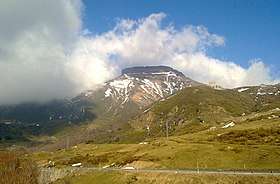 Peña Labra viewed from Piedrasluengas. | |
| Highest point | |
| Elevation | 2018 m (approx 6,620 ft) |
| Prominence | 77 m. |
| Coordinates | 43°2′52.080″N 4°25′55.992″W / 43.04780000°N 4.43222000°WCoordinates: 43°2′52.080″N 4°25′55.992″W / 43.04780000°N 4.43222000°W |
| Geography | |
 Peña Labra | |
| Parent range |
Sierra de Híjar, Cantabrian Mountains System |
| Climbing | |
| Easiest route | SW, from Piedrasluengas. |
Peña Labra is a 2,018 metres (6,621 ft) high mountain located in the Sierra de Híjar range, a part of the Cantabrian Mountains System,. It is located on the boundary between the Province of Palencia and the Autonomous Community of Cantabria.
It is the westernmost peak of the Alto Campoo Massif.
The main trailhead for the mountain is at Puerto de Piedrasluengas, located at an elevation of 1,355 metres (4,446 ft), 22 kilometres (14 mi) from Potes in Cantabria and 29 kilometres (18 mi) from Cervera de Pisuerga in Palencia, on the road CL-627.[1]
References
- ↑ "Peña Labra". SummitPost.org. Archived from the original on February 14, 2016. Retrieved February 14, 2016.
This article is issued from
Wikipedia.
The text is licensed under Creative Commons - Attribution - Sharealike.
Additional terms may apply for the media files.