Paulson, Manitoba
| Paulson | |
|---|---|
 Paulson Location of Paulson in Manitoba | |
| Coordinates: 51°6′55″N 99°55′58″W / 51.11528°N 99.93278°WCoordinates: 51°6′55″N 99°55′58″W / 51.11528°N 99.93278°W[1] | |
| Country | Canada |
| Province | Manitoba |
| Region | Parkland |
| Elevation[2] | 287 m (942 ft) |
| Time zone | UTC-6 (CST) |
| • Summer (DST) | UTC-5 (CDST) |
| Area code(s) | 204 |
Paulson is a locality in Manitoba, Canada.[1] It is located 9 kilometres (6 mi) southeast of Dauphin and 186 miles (299 km) northwest of Winnipeg.
Paulson lies within the Rural Municipality of Dauphin.
Royal Canadian Air Force
RCAF Station Paulson was the site of British Commonwealth Air Training Plan No. 7 Bombing & Gunnery School during World War II.[3]
References
- 1 2 "Paulson". Geographical Names Data Base. Natural Resources Canada. Retrieved 2012-06-13.
- ↑ At geographic coordinates, per Google Earth
- ↑ Hatch, F. J. (1983). The Aerodrome of Democracy: Canada and the British Commonwealth Air Training Plan, 1939-1945. Ottawa: Directorate of History, Department of National Defence. ISBN 0660114437.
| Cities | 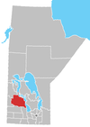 | ||
|---|---|---|---|
| Towns |
| ||
| Villages |
| ||
| Rural municipalities |
| ||
| First Nations | |||
| Indian reserves | |||
| Unorganized areas | |||
| Unincorporated communities |
| ||
This article is issued from
Wikipedia.
The text is licensed under Creative Commons - Attribution - Sharealike.
Additional terms may apply for the media files.