Pateley Bridge
| Pateley Bridge | |
|---|---|
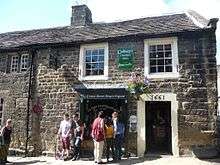
.JPG) High Street, Pateley Bridge | |
 Pateley Bridge Pateley Bridge shown within North Yorkshire | |
| Population | 2,210 (2011) |
| OS grid reference | SE155655 |
| Civil parish |
|
| District | |
| Shire county | |
| Region | |
| Country | England |
| Sovereign state | United Kingdom |
| Post town | Harrogate |
| Postcode district | HG3 |
| Dialling code | 01423 |
| Police | North Yorkshire |
| Fire | North Yorkshire |
| Ambulance | Yorkshire |
| EU Parliament | Yorkshire and the Humber |
| UK Parliament | |
Pateley Bridge (known locally as Pateley) is a small market town in Nidderdale in the Borough of Harrogate, North Yorkshire, England. Historically part of the West Riding of Yorkshire, it lies on the River Nidd.
It has the oldest sweet shop in England. Established in 1827, it is housed in one of the earliest buildings in Pateley Bridge, dating from 1661.[1] Pateley Bridge is also the home of the Nidderdale Museum.
The last Dales agricultural show of the year, the Nidderdale Show, is held annually on the showground by the River Nidd. The show attracts over 14,000 visitors each year.
The town was listed in both the 2017 and 2018 Sunday Times reports on Best Places to Live in northern England.[2]
History
In the early Middle Ages the site of Pateley lay in lands of the Archbishop of York, which came to be known as Bishopside. In the 12th century the principal settlement in Bishopside was at Wilsill, rather than Pateley.[3] Pateley was first recorded in 1175 (though the document survives in a later copy), as Patleiagate, with 14th century forms including Patheleybrig(ge). The final elements are clear, deriving from Old Norse gata ('street') and the northern dialect form brig ('bridge') respectively. There is more debate about the Pateley section of the name: the usual explanation is Old English pæþ ('path') in the genitive plural form paða + lēah ('open ground, clearing in a forest'); paða lēah would mean "woodland clearing of the paths", referring to paths up Nidderdale and from Ripon to Craven, which intersected here.[4] However, the Pateley name forms competed in the Middle Ages with forms like Padlewath (1227) and Patheslayewathe which could be from Middle English *padil ('a shallow place in water') + Old Norse vath ('ford') and it could be that they owe something to this name.[5] The local story that the name comes from 'Pate', an old Yorkshire dialect word for 'Badger',[6] is incorrect.[7]
In 1320 the Archbishop of York granted a charter for a market and fair at Pateley.[8] From the 14th century until the early part of the 20th century, Scotgate Ash Quarry despatched hard-wearing sandstone from its site on the northern flank above Pateley Bridge. When the railway arrived in Nidderdale, the stone was exported by trains and was used in railway platforms, national buildings and harbour walls. Scotgate Ash Quarry closed in 1915.[9]
Until 1964, Pateley Bridge railway station was the terminus of the railway line running up Nidderdale from Nidd Valley Junction, near Harrogate. Between 1907 and 1937, the Nidd Valley Light Railway ran farther up the dale. Access is now by road, with an hourly bus service from Harrogate.[10]
Local government
Pateley Bridge was once in the Lower Division of Claro Wapentake. In the 19th century local government reforms the town fell within the Pateley Bridge Poor Law Union,[11] later the Pateley Bridge Rural Sanitary District[12] and from 1894 Pateley Bridge Rural District.[13] In 1937 the rural district was merged to become part of Ripon and Pateley Bridge Rural District.[14]
Since 1974 the town has fallen within the Borough of Harrogate in North Yorkshire.
Pateley Bridge is the largest settlement in the civil parish of High and Low Bishopside, historically a township in the large parish of Ripon. High and Low Bishopside was created a civil parish in 1866.[15] Pateley Bridge was granted town status in 1986, and the High and Low Bishopside Parish Council was renamed Pateley Bridge Town Council.[16] However, the official name of the parish remains High and Low Bishopside.
The parish is bounded on the west by the River Nidd, and includes a large area of moorland to the east of the town. Other settlements in the parish include the southern part of Wath, Glasshouses, Wilsill, Blazefield and Fellbeck. The parish does not include the Nidderdale showground or the district of Bridgehouse Gate, which are on the west bank of the Nidd in the parish of Bewerley.
In the 2001 census the parish had a population of 2,153,[17] increasing to 2,210 at the 2011 Census.[18]
Governance
An electoral ward in the name of Pateley Bridge exists. This stretches north to Stonebeck Up with a total population taken at the 2011 Census of 2,718.[19]
Amenities
Bed & breakfast houses, church and chapel, garage (Nidderdale Motors), hotels, Nidderdale Museum, primary school, public houses, public library, public park, restaurants, secondary school (Nidderdale High School), shops and theatre (Pateley Playhouse). Bewerley Park Centre for Outdoor Education is in the nearby village of Bewerley. Brimham Rocks and Stump Cross Caverns are also close by.
The Nidderdale Way and Six Dales Trail both pass through the town.
The town also serves as a sporting hub, with several teams (known collectively as 'The Badgers') competing in football, cricket and crown green bowling.
Pateley is also served by Nidderdale Pool and Leisure Centre. Comprising a 20-metre swimming pool, fully equipped gym and sport hall and two squash courts, the facility officially opened in 2005 after many years of local fundraising.
The football team, known as Pateley Bridge F.C. currently competes in the 14th level of the footballing pyramid in the Harrogate and District Football League Premier.
The town is also famous for the "Oldest Sweet Shop in England" which was established in 1827 and is validated as the longest continuous trading sweet shop in the world (Guinness World Records Book 2014) and is housed in one of the oldest buildings in Pateley Bridge.
King Street workshops can be found on King Street & house a talented group of artists and designers. Their studios are open and they include jewellers, milliner, textile art & gifts, sculptors, fine artist and glassblowers.
Climate
Like much of the British Isles, Pateley Bridge has a Temperate Maritime Climate. The warmest temperature recorded was 31.0 °C (87.8 °F) on 1 July 2015. The nearest location where data is available is Dishforth Airfield. It is particularly notable that the warmest and the coldest temperatures for May both occurred in 2010, within the space of just 12 days. The heatwave at the beginning of October 2011 was so extreme that the warmest October temperature was recorded, and it was higher than the record high of September in any year. With a mean temperature of 11.4 °C (52.5 °F), December 2015 was easily the warmest December ever recorded, and the warmest ever December temperature of 16.2 °C (61.2 °F) was reached on 19th. In contrast, the December 2010 mean temperature was −1.9 °C (28.6 °F), and the coldest ever temperature of −15.0 °C (5.0 °F) was reached on the 6th.[20]
| Climate data for Pateley Bridge, 154m amsl (1981–2010) (extremes 1992–) | |||||||||||||
|---|---|---|---|---|---|---|---|---|---|---|---|---|---|
| Month | Jan | Feb | Mar | Apr | May | Jun | Jul | Aug | Sep | Oct | Nov | Dec | Year |
| Record high °C (°F) | 14.6 (58.3) |
16.2 (61.2) |
21.0 (69.8) |
23.9 (75) |
27.2 (81) |
30.6 (87.1) |
31.0 (87.8) |
30.8 (87.4) |
27.2 (81) |
27.5 (81.5) |
17.7 (63.9) |
16.2 (61.2) |
31 (87.8) |
| Average high °C (°F) | 6.8 (44.2) |
7.3 (45.1) |
9.9 (49.8) |
12.4 (54.3) |
15.7 (60.3) |
18.5 (65.3) |
21.0 (69.8) |
20.5 (68.9) |
17.8 (64) |
13.6 (56.5) |
9.6 (49.3) |
6.8 (44.2) |
13.3 (56) |
| Average low °C (°F) | 0.8 (33.4) |
0.8 (33.4) |
2.2 (36) |
3.8 (38.8) |
6.4 (43.5) |
9.3 (48.7) |
11.5 (52.7) |
11.2 (52.2) |
9.2 (48.6) |
6.4 (43.5) |
3.2 (37.8) |
0.8 (33.4) |
5.5 (41.8) |
| Record low °C (°F) | −11.0 (12.2) |
−8.8 (16.2) |
−7.2 (19) |
−4.1 (24.6) |
−2.5 (27.5) |
1.6 (34.9) |
4.2 (39.6) |
2.5 (36.5) |
0.8 (33.4) |
−4.3 (24.3) |
−9.0 (15.8) |
−15.0 (5) |
−15 (5) |
| Average precipitation mm (inches) | 53.2 (2.094) |
42.2 (1.661) |
45.7 (1.799) |
49.3 (1.941) |
45.1 (1.776) |
59.8 (2.354) |
51.2 (2.016) |
60.1 (2.366) |
53.4 (2.102) |
64.0 (2.52) |
60.3 (2.374) |
58.6 (2.307) |
642.9 (25.31) |
| Average rainy days (≥ 1 mm) | 11.8 | 9.2 | 9.1 | 9.4 | 9.8 | 9.9 | 9.0 | 9.6 | 8.7 | 10.7 | 10.9 | 10.3 | 118.4 |
| Mean monthly sunshine hours | 51.2 | 76.6 | 107.0 | 159.5 | 190.5 | 162.2 | 184.5 | 173.0 | 133.9 | 96.1 | 60.3 | 58.6 | 1,453.4 |
| Source #1: Met Office[21] | |||||||||||||
| Source #2: Climate Dishforth[22] | |||||||||||||
References
- ↑ "Oldest sweet shop". Guinness World Records. 2017. Retrieved 4 August 2017.
- ↑ https://www.yorkshirepost.co.uk/news/six-yorkshire-postcodes-appear-in-sunday-times-best-places-to-live-guide-for-2018-1-9067173
- ↑ Jennings, p.30
- ↑ Smith, A.H. (1961). The Place-names of the West Riding of Yorkshire. 5. Cambridge University Press. p. 149.
- ↑ Victor Watts (ed.), The Cambridge Dictionary of English Place-Names Based on the Collections of the English Place-Name Society (Cambridge: Cambridge University Press, 2004), s.v. PATELEY BRIDGE.
- ↑ "Archived copy". Archived from the original on 6 November 2009. Retrieved 18 October 2009.
- ↑ Jennings, p.23
- ↑ Jennings, pp.79–80
- ↑ "Walking: Nidderdale at its glorious best". Yorkshire Evening Post. 8 January 2016. Retrieved 11 September 2017.
- ↑ Bus 24 timetable
- ↑ Vision of Britain: Pateley Bridge RegD/PLU
- ↑ Vision of Britain: Pateley Bridge RSD
- ↑ Vision of Britain: Pately Bridge RD
- ↑ Vision of Britain: Ripon and Pateley Bridge RD
- ↑ "High and Low Bishopside Ch/CP through time | Census tables with data for the Parish-level Unit". www.visionofbritain.org.uk. Retrieved 6 December 2017.
- ↑ Pateley Bridge Town Council website
- ↑ "Parish Headcounts, 2001 – Area: High and Low Bishopside CP (Parish)". Neighbourhood Statistics. Office for National Statistics. Retrieved 31 January 2016.
- ↑ "Civil Parish population 2011". Neighbourhood Statistics. Office for National Statistics. Retrieved 5 August 2015.
- ↑ "Key Figures for 2011 Census: Key Statistics – Area: Pateley Bridge (Ward)". Neighbourhood Statistics. Office for National Statistics. Retrieved 31 January 2016.
- ↑ http://en.tutiempo.net/climate/ws-32610.html
- ↑ http://www.metoffice.gov.uk/public/weather/climate/gcwg8jffz
- ↑ http://en.tutiempo.net/climate/ws-32610.html
Further reading
- Jennings, Bernard (1992). A History of Nidderdale. ISBN 1 85072 114 9.