Parry Sound Area Municipal Airport
| Parry Sound Area Municipal Airport | |||||||||||
|---|---|---|---|---|---|---|---|---|---|---|---|
 | |||||||||||
| Summary | |||||||||||
| Airport type | Public | ||||||||||
| Owner | Municipally owned | ||||||||||
| Operator | Airport Commission | ||||||||||
| Serves | Parry Sound, Ontario, Canada | ||||||||||
| Time zone | EST (UTC−05:00) | ||||||||||
| • Summer (DST) | EDT (UTC−04:00) | ||||||||||
| Elevation AMSL | 830 ft / 253 m | ||||||||||
| Coordinates | 45°15′27″N 079°49′47″W / 45.25750°N 79.82972°WCoordinates: 45°15′27″N 079°49′47″W / 45.25750°N 79.82972°W | ||||||||||
| Website | http://www.parrysoundairport.com/ | ||||||||||
| Map | |||||||||||
 CNK4 Location in Ontario  CNK4 CNK4 (Canada) | |||||||||||
| Runways | |||||||||||
| |||||||||||
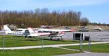
Parry Sound Area Municipal Airport, (IATA: YPD, TC LID: CNK4), is located 12 nautical miles (22 km; 14 mi) southeast of Parry Sound, Ontario, Canada.
This airport serves both the Parry Sound community and as a passage to the north. Located just north of the top of Lake Joseph, it also offers a fuel and rest point for pilots of smaller aircraft in the cottage country area.
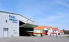
Hangars at Parry Sound Airport
See also
References
- ↑ Canada Flight Supplement. Effective 0901Z 19 July 2018 to 0901Z 13 September 2018.
- ↑ Synoptic/Metstat Station Information Archived June 28, 2013, at the Wayback Machine.
| By name | |
|---|---|
| By location indicator | |
| By province/territory | |
| By area | |
| National Airports System | |
| Related | |
| |
This article is issued from
Wikipedia.
The text is licensed under Creative Commons - Attribution - Sharealike.
Additional terms may apply for the media files.