Parry Peninsula
 Parry Peninsula, Canada and inset showing Alaska. | |
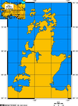
 Parry Peninsula Location of the Parry Peninsula in the Northwest Territories | |
| Geography | |
|---|---|
| Location | Northwest territories, Canada |
| Coordinates | 69°40′01″N 124°40′01″W / 69.667°N 124.667°WCoordinates: 69°40′01″N 124°40′01″W / 69.667°N 124.667°W |
| Adjacent bodies of water | Arctic Ocean |
| Administration | |
|
Canada | |
The Parry Peninsula on the north coast of Canada's Northwest Territories is bounded on the west by Franklin Bay, on the north by Amundsen Gulf, and on the east by Darnley Bay.The nearest settlement is Paulatuk. It is also home to the Cape Parry Migratory Bird Sanctuary on the northern extremity of the Parry Peninsula.[1]
History
It is named for the Arctic explorer William Edward Parry. On the northern tip of the peninsula is Cape Parry. A headland, and a Distant Early Warning Line site on Parry Peninsula northern tip.[2]
See also
References
- ↑ "Cape Parry Migratory Bird Sanctuary". Environment and Climate Change Canada. Government of Canada. Retrieved 4 March 2016.
- ↑ Wilson, Larry. "Cape Parry NWT PIN-Main". Larry Wilson - Dew Line Adventures. Dew Line Adventures. Retrieved 4 March 2016.
Further reading
- Daniel Ernest Kerr; Geological Survey of Canada (1994). Ernest Kerr, Daniel, ed. Late quaternary stratigraphy and depositional history of the Parry Peninsula-Perry River area, District of MacKenzie, Northwest Territories / (Book, Geology, Stratigraphy) (in English and French) (465 ed.). p. 34. ISBN 0-660-15411-0. Retrieved 4 March 2016.
This article is issued from
Wikipedia.
The text is licensed under Creative Commons - Attribution - Sharealike.
Additional terms may apply for the media files.