Parran, Maryland
| Parran, Maryland | |
|---|---|
| Unincorporated community | |
 Parran | |
| Coordinates: 38°36′10″N 76°34′13″W / 38.60278°N 76.57028°WCoordinates: 38°36′10″N 76°34′13″W / 38.60278°N 76.57028°W | |
| Country | United States |
| State | Maryland |
| County | Calvert |
| Elevation | 135 ft (41 m) |
| Time zone | UTC-5 (Eastern (EST)) |
| • Summer (DST) | UTC-4 (EDT) |
| ZIP code | 20639 |
| Area code(s) | 410, 443, and 667 |
| GNIS feature ID | 590980[1] |
Parran is an unincorporated community located at the crossroads of MD 263, Cox Road, and Emmanuel Church Road in Calvert County, Maryland, United States.[1] Cornehill was listed on the National Register of Historic Places in 1973.[2]
References
- 1 2 "Parran". Geographic Names Information System. United States Geological Survey.
- ↑ National Park Service (2008-04-15). "National Register Information System". National Register of Historic Places. National Park Service.
Municipalities and communities of Calvert County, Maryland, United States | ||
|---|---|---|
| Towns | 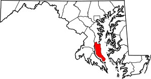 | |
| CDPs | ||
| Other communities | ||
| Ghost town | ||
This article is issued from
Wikipedia.
The text is licensed under Creative Commons - Attribution - Sharealike.
Additional terms may apply for the media files.