Parndana, South Australia
| Parndana South Australia | |||||||||||||||
|---|---|---|---|---|---|---|---|---|---|---|---|---|---|---|---|
 Parndana | |||||||||||||||
 Parndana | |||||||||||||||
| Coordinates | 35°47′25″S 137°15′46″E / 35.79028°S 137.26278°ECoordinates: 35°47′25″S 137°15′46″E / 35.79028°S 137.26278°E | ||||||||||||||
| Population | 142 (2011 census)[1] | ||||||||||||||
| Established | 26 July 1951[2] | ||||||||||||||
| Postcode(s) | 5220[3] | ||||||||||||||
| Time zone | ACST (UTC+9:30) | ||||||||||||||
| • Summer (DST) | ACDT (UTC+10:30) | ||||||||||||||
| Location | |||||||||||||||
| LGA(s) | Kangaroo Island Council | ||||||||||||||
| Region | Fleurieu and Kangaroo Island[4] | ||||||||||||||
| County | Carnarvon[5] | ||||||||||||||
| State electorate(s) | Mawson[6] | ||||||||||||||
| Federal Division(s) | Mayo[7] | ||||||||||||||
| |||||||||||||||
| |||||||||||||||
| Footnotes |
Location[3] Adjoining localities[5] | ||||||||||||||
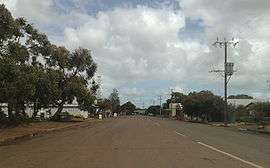
Parndana is a small town on Kangaroo Island, South Australia, located 40 km west of Kingscote, the island's largest town.
History
Parndana was established after the Second World War to support the Soldier Settlement Scheme on Kangaroo Island. The name "Parndana" means "The Place of Little Gums".[9]
Returned soldiers and their families began to arrive in the area in 1948, occupying huts brought from a former internment camp, and began to move onto their farms in 1951. A total of 174 families came to live in the area, almost doubling Kangaroo Island's population by 1954.[10]
The Town of Parndana which was proclaimed on 26 July 1951 under the Crown Lands Act 1929-1944, occupied a triangular-shaped area of land in the cadastral unit of the Hundred of Seddon bounded by the Playford Highway on the north-west, the Rowland Hill Highway to the south-west and the Wedgewood Road to the east.[5][2]
The soldier settlements were established on Crown land, which first had to be cleared of heavy native vegetation. Returned soldiers had to agree to live and work in camps to undertake this clearance work for a number of years before being allocated a block of land which then required further development before they could begin to farm the land, the costs of this further development being bourne by the settlers using government loans (arbitrarily administered by public servants without any specific knowledge of farming needs in the district). Many settlers were unable to succeed in raising sheep (recommended as the best use of the land) because of the widespread use of the Yarloop clover (recommended for use in heavy wet soils), which was subsequently discovered to reduce the fertility of sheep,[11] but at the time the settlers were blamed for their poor farm management skills. Later it was an expensive exercise for farmers to remove the Yarloop clover and replace it with other varieties of clover. As a consequence of these issues, by the 1970s some settlers were in desperate financial circumstances and the government wanted to foreclose on their loans, forcing them to sell their farms, leading to desperate protests and legal action based on the misadvice they had received from public servants.[12]
Facilities
The town has an area school for years reception to 12, a community hotel and two general stores.
The Parndana Research Centre was established to the south of the town as a support for early farming activities but closed in the 1990s.
Attractions
The Soldier Settlement Museum provides information and artefacts relating to the soldier settlement program.[13]
Sports
The Parndana Football Club first fielded teams in 1948, 1949 and 1951 during the early days of the land clearing operations, before being permanently admitted to the Kangaroo Island football league in February 1956.[14]
Climate
| Climate data for Parndana East Research Station (sic) (155m ASL), Seddon, South Australia[15] | |||||||||||||
|---|---|---|---|---|---|---|---|---|---|---|---|---|---|
| Month | Jan | Feb | Mar | Apr | May | Jun | Jul | Aug | Sep | Oct | Nov | Dec | Year |
| Record high °C (°F) | 43.0 (109.4) |
41.7 (107.1) |
38.6 (101.5) |
33.2 (91.8) |
26.7 (80.1) |
20.3 (68.5) |
22.2 (72) |
23.4 (74.1) |
26.9 (80.4) |
32.4 (90.3) |
41.1 (106) |
41.3 (106.3) |
43.0 (109.4) |
| Average high °C (°F) | 24.8 (76.6) |
25.2 (77.4) |
22.7 (72.9) |
20.1 (68.2) |
16.6 (61.9) |
14.2 (57.6) |
13.5 (56.3) |
14.1 (57.4) |
15.4 (59.7) |
17.7 (63.9) |
20.5 (68.9) |
23.1 (73.6) |
19.0 (66.2) |
| Daily mean °C (°F) | 18.7 (65.7) |
19.3 (66.7) |
17.5 (63.5) |
15.4 (59.7) |
12.8 (55) |
10.8 (51.4) |
10.0 (50) |
10.3 (50.5) |
11.2 (52.2) |
12.9 (55.2) |
14.9 (58.8) |
17.1 (62.8) |
14.2 (57.6) |
| Average low °C (°F) | 12.5 (54.5) |
13.3 (55.9) |
12.2 (54) |
10.6 (51.1) |
8.9 (48) |
7.3 (45.1) |
6.5 (43.7) |
6.5 (43.7) |
7.0 (44.6) |
8.1 (46.6) |
9.3 (48.7) |
11.0 (51.8) |
9.4 (48.9) |
| Record low °C (°F) | 5.0 (41) |
4.8 (40.6) |
5.0 (41) |
2.0 (35.6) |
0.9 (33.6) |
−0.6 (30.9) |
−2.5 (27.5) |
−1.0 (30.2) |
1.1 (34) |
0.1 (32.2) |
1.2 (34.2) |
2.8 (37) |
−2.5 (27.5) |
| Average rainfall mm (inches) | 16.5 (0.65) |
21.1 (0.831) |
29.0 (1.142) |
49.2 (1.937) |
74.4 (2.929) |
87.9 (3.461) |
101.5 (3.996) |
86.1 (3.39) |
63.9 (2.516) |
45.4 (1.787) |
28.7 (1.13) |
23.6 (0.929) |
627.4 (24.701) |
| Average rainy days | 6.7 | 6.1 | 9.8 | 13.3 | 18.1 | 18.5 | 22.0 | 21.6 | 18.6 | 14.7 | 11.0 | 9.2 | 169.6 |
| Average relative humidity (%) (at 3pm) | 48 | 49 | 56 | 60 | 69 | 75 | 76 | 72 | 69 | 64 | 56 | 52 | 62 |
| Source: [16] | |||||||||||||
Notes
- ↑ Australian Bureau of Statistics (31 October 2012). "Parndana (State Suburb)". 2011 Census QuickStats. Retrieved 30 May 2016.

- 1 2 "TOWN OF PARNDANA" (PDF). The South Australian Government Gazette. Government of South Australia: 174. 26 July 1951. Retrieved 18 January 2017.
- 1 2 "Postcode for Parndana, South Australia (Postcode)". postcodes-australia.com. Retrieved 18 January 2017.
- ↑ "Fleurieu and Kangaroo Island SA Government region" (PDF). The Government of South Australia. Retrieved 9 September 2016.
- 1 2 3 "Search result for " Parndana (LOCB)" (Record no SA0053653) with the following layers selected - "Suburbs and Localities"". Property Location Browser. Government of South Australia. Retrieved 24 May 2016.
- ↑ Mawson (Map). Electoral District Boundaries Commission. 2016. Retrieved 2 March 2018.
- ↑ "Federal electoral division of Mayo, boundary gazetted 16 December 2011" (PDF). Australian Electoral Commission. Retrieved 2 August 2015.
- 1 2 3 "Monthly climate statistics: Summary statistics KINGSCOTE Aero (nearest station)". Commonwealth of Australia , Bureau of Meteorology. Retrieved 18 January 2017.
- ↑ "The Open House - Parndana History". Archived from the original on 2007-07-05. Retrieved 2007-07-12.
- ↑ Susan Marsden (2004). "Twentieth Century Heritage Survey - Stage 1:Post Second World War (1946 -1959)" (PDF). Department for Environment and Heritage, South Australia. Retrieved 2007-07-12.
- ↑ Croker, Keith; Nichols, Phil; Barbetti, Martin; Adams, Norm. "Sheep infertility from pasture legumes" (PDF). Department of Agriculture, Western Australia. Archived from the original (PDF) on 6 August 2013.
- ↑ Nunn, Jean (1981), Soldier settlers : war service land settlement Kangaroo Island, Investigator Press, ISBN 978-0-85864-051-1
- ↑ The Islander. "New contributions to the Parndana Soldier Settler Museum". Retrieved 2018-09-08.
- ↑ "Parndana Football Club History". Archived from the original on 30 September 2007. Retrieved 12 July 2007.
- ↑ "Search results for 'Parndana Agricultural Research Centre,' with the following datasets selected - 'Suburbs and Localities' and 'Gazetteer'". Location SA Map viewer. South Australian Government. Retrieved 2 March 2018.
- ↑ "Climate Data Online". Retrieved January 14, 2018.
External links
| Wikimedia Commons has media related to Pardana, South Australia. |
| Major townships | |||||||||
|---|---|---|---|---|---|---|---|---|---|
| Beaches | |||||||||
| Coastal features |
| ||||||||
| Protected areas |
| ||||||||
| Islands adjacent to Kangaroo Island coast | |||||||||
| Related and uncategorised | |||||||||
| |||||||||