Parish of Gwynne (Mouramba County)
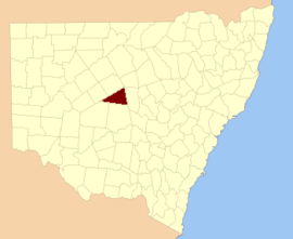
Mouramba County
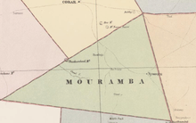
Map of Mouramba County (New South Wales) in 1886.[1]
Gwynne Parish in Mouramba County,[2] central New South Wales is a cadasteral parish of Australia.[3] The topography of the parish is generally flat with a thin scrub forest and the main economy of the area is agriculture.
The parish is on the Kidman Way south of Cobar, New South Wales.
References
- ↑ John Sands, Atlas of Australia 1886.
- ↑ "Mouramba County". Geographical Names Register (GNR) of NSW. Geographical Names Board of New South Wales.
- ↑ Map of the County of Mouramba, New South Wales. Department of Lands 1916.
This article is issued from
Wikipedia.
The text is licensed under Creative Commons - Attribution - Sharealike.
Additional terms may apply for the media files.