Parish of Goold
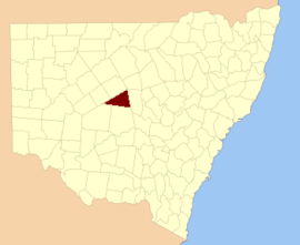
Mouramba County
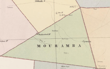
Map of Mouramba County (New South Wales) in 1886.[1]
Goold Parish in Mouramba County,[2] central New South Wales is a cadasteral parish of Australia. The topography of the parish is generally flat with a thin scrub forest and the main economy of the area is agriculture.
The parish is on the Kidman Way just outside the Balowra State Conservation Area and the nearest town is Nymagee, New South Wales.
References
- ↑ from John Sands, Atlas of Australia 1886.
- ↑ "Mouramba County". Geographical Names Register (GNR) of NSW. Geographical Names Board of New South Wales.
This article is issued from
Wikipedia.
The text is licensed under Creative Commons - Attribution - Sharealike.
Additional terms may apply for the media files.