List of signed parish roads in Louisiana
| Parish Roads in Louisiana | |
|---|---|
|
Standard parish highway marker used in Louisiana | |
| System information | |
| Maintained by various local parish governments | |
| Highway names | |
| Parish: | Parish Road X (PR X) |
| System links | |
| |
Parish Roads in Louisiana include all public roadways that are controlled and maintained by the local government of the parish in which they are located.
The existence of a system of parish roads signed as touring routes varies greatly by parish. To most motorists in Louisiana, the only visible parish roads with numerical designations are the few that appear on state-maintained signage at various Interstate Highway exits.
This list includes all nine instances where a parish road intersects an Interstate Highway and features MUTCD standard signage installed by the Louisiana Department of Transportation and Development (La DOTD), the state's highway agency. It also includes several examples of parish roads that are signed by the state due to their close proximity to an Interstate Highway or their status as part of an interstate frontage road.
Caddo Parish Road 16
| |
|---|---|
| Location | Caddo Parish |
| Length | 6.199 mi[1] (9.976 km) |
Caddo Parish Road 16 (PR 16) runs 6.20 miles (9.98 km) in an east–west direction from LA 1 north of Myrtis to US 71 in Mira. It is locally known as Mira Myrtis Road.
PR 16 is only signed from intersecting state highways by La DOTD. The designation is most visible on the exit signage for its interchange with I-49 at Mira. The posted speed limit is 55 mph (90 km/h).
The entire highway is in Caddo Parish.
| Location | mi[1] | km | Destinations | Notes | |
|---|---|---|---|---|---|
| Myrtis | 6.199 | 9.976 | Western terminus | ||
| Mira | 0.470– 0.326 | 0.756– 0.525 | Exit 241 on I-49 | ||
| 0.000 | 0.000 | Eastern terminus | |||
| 1.000 mi = 1.609 km; 1.000 km = 0.621 mi | |||||
DeSoto Parish Road 16
| |
|---|---|
| Location | DeSoto Parish |
| Length | 5.030 mi[1] (8.095 km) |
DeSoto Parish Road 16 (PR 16) runs 5.03 miles (8.10 km) in a general northwest to southeast direction from the junction of I-49 and LA 3276 in Stonewall to LA 175 in Frierson. It is locally known as Stonewall-Frierson Road.
PR 16 is only signed at the I-49 interchange by La DOTD. The posted speed limit is 45 mph (70 km/h).
The entire highway is in DeSoto Parish.
| Location | mi[1] | km | Destinations | Notes | |
|---|---|---|---|---|---|
| Stonewall | 0.000 | 0.000 | Western terminus of PR 16; eastern terminus of LA 3276 | ||
| Frierson | 5.030 | 8.095 | Eastern terminus | ||
| 1.000 mi = 1.609 km; 1.000 km = 0.621 mi | |||||
Livingston Parish Road 45
| |
|---|---|
| Location | Livingston Parish |
| Length | 8.938 mi[1] (14.384 km) |
Livingston Parish Road 45 (PR 45) runs 8.94 miles (14.39 km) in a north–south direction from LA 42 at Colyell to US 190 at Satsuma. It is locally known as South Satsuma Road.
PR 45 is only signed at its interchange with I-12 by La DOTD. The posted speed limit is 45 mph (70 km/h).
The entire highway is in Livingston Parish.
| Location | mi[1] | km | Destinations | Notes | |
|---|---|---|---|---|---|
| Colyell | 0.000 | 0.000 | Southern terminus | ||
| | 6.559– 6.902 | 10.556– 11.108 | Exit 19 on I-12 | ||
| Satsuma | 8.938 | 14.384 | Northern terminus | ||
| 1.000 mi = 1.609 km; 1.000 km = 0.621 mi | |||||
Natchitoches Parish Road 547
| |
|---|---|
| Location | Natchitoches Parish |
| Length | 8.802 mi[1] (14.165 km) |
Natchitoches Parish Road 547 (PR 547) runs 8.80 miles (14.16 km) in a general east–west direction from LA 1222 northeast of Robeline to PR 441 (Johnson Chute Road) west of Natchitoches. It is locally known as Posey Road.
PR 547 is only signed with standard markers at its interchange with I-49 by La DOTD. However, its number does appear on local street signs next to its local name.
The entire route is in Natchitoches Parish.
| mi[1] | km | Destinations | Notes | ||
|---|---|---|---|---|---|
| 0.000 | 0.000 | Western terminus of PR 547; eastern terminus of LA 1222 | |||
| 7.986– 8.162 | 12.852– 13.135 | Exit 142 on I-49 | |||
| 8.802 | 14.165 | Eastern terminus | |||
| 1.000 mi = 1.609 km; 1.000 km = 0.621 mi | |||||
Natchitoches Parish Road 620
| |
|---|---|
| Location | Natchitoches Parish |
| Length | 1.993 mi[1] (3.207 km) |
Natchitoches Parish Road 620 (PR 620) runs 1.993 miles (3.207 km) in an east–west direction from the I-49 frontage road in Natchitoches to PR 615 (Old River Road) south of Natchez. It is locally known as Flora-Natchez Road.
PR 620 is only signed with standard markers at the junction of LA 478 and Flora-Natchez Road near the former's interchange with I-49. However, its number does appear on local street signs next to its local name.
The western segment of Flora-Natchez Road, including its intersection with LA 478, was relocated by La DOTD in the 1980s to accommodate the I-49 interchange. The resulting 0.37-mile (0.60 km) road segment is state-maintained and internally designated as a frontage road for I-49, the remainder being the parish-maintained PR 620.
The entire highway is in Natchitoches Parish.
| Location | mi[1] | km | Destinations | Notes | |
|---|---|---|---|---|---|
| Natchitoches | 0.000 | 0.000 | Western terminus | ||
| | 1.993 | 3.207 | Eastern terminus | ||
| 1.000 mi = 1.609 km; 1.000 km = 0.621 mi | |||||
Natchitoches Parish Road 820
| |
|---|---|
| Location | Natchitoches Parish |
| Length | 8.112 mi[1] (13.055 km) |
Natchitoches Parish Road 820 (PR 820) runs 8.11 miles (13.05 km) in a general northwest to southeast direction from Coco Bed Road in Cloutierville to LA 490 in Chopin. It is locally known as Emmanuel Road.
PR 820 is only signed with standard markers at its junction with LA 490 near an interchange with I-49. However, its number does appear on local street signs next to its local name.
The entire highway is in Natchitoches Parish.
| Location | mi[1] | km | Destinations | Notes | |
|---|---|---|---|---|---|
| Cloutierville | 8.112 | 13.055 | Coco Bed Road | Western terminus | |
| Chopin | 0.000 | 0.000 | Eastern terminus | ||
| 1.000 mi = 1.609 km; 1.000 km = 0.621 mi | |||||
Natchitoches Parish Road 829
| |
|---|---|
| Location | Natchitoches Parish |
| Length | 5.717 mi[1] (9.201 km) |
Natchitoches Parish Road 829 (PR 829) runs 5.72 miles (9.21 km) in an east–west direction from the junction of LA 493 and Forest Service Road 339 (FS 339) south of Montrose to LA 119 in Derry. It is locally known as Bayou Derbonne Road.
PR 829 is only signed with standard markers at its junction with LA 119 near an interchange with I-49. However, its number does appear on local street signs next to its local name.
The entire highway is in Natchitoches Parish.
| Location | mi[1] | km | Destinations | Notes | |
|---|---|---|---|---|---|
| | 5.717 | 9.201 | Forest Service Road 339 – Red Dirt, Longleaf Vista | Western terminus | |
| Derry | 0.000 | 0.000 | Eastern terminus | ||
| 1.000 mi = 1.609 km; 1.000 km = 0.621 mi | |||||
Ouachita Parish Road 25
| |
|---|---|
| Location | Ouachita Parish |
| Length | 2.475 mi[1] (3.983 km) |
Ouachita Parish Road 25 (PR 25) runs 2.48 miles (3.99 km) in a general southeast to northwest direction from Cheniere Station Road in Cheniere to US 80 northwest to Cheniere. It is locally known as Camp Road.
PR 25 is only signed at its interchange with I-20 by La DOTD. The posted speed limit is 45 mph (70 km/h).
The entire highway is in Ouachita Parish.
| Location | mi[1] | km | Destinations | Notes | |
|---|---|---|---|---|---|
| Cheniere | 2.475 | 3.983 | Cheniere Station Road | Southern terminus | |
| | 1.111– 0.720 | 1.788– 1.159 | Exit 107 on I-20 | ||
| | 0.000 | 0.000 | Northern terminus | ||
| 1.000 mi = 1.609 km; 1.000 km = 0.621 mi | |||||
Rapides Parish Road 22
| |
|---|---|
| Location | Rapides Parish |
| Length | 1.995 mi[1] (3.211 km) |
Rapides Parish Road 22 (PR 22) runs 2.00 miles (3.22 km) in an east–west direction from the junction of I-49 and LA 3265 in Woodworth to LA 470 east of Woodworth.
PR 22 is only signed at its interchange with I-49 by La DOTD. The posted speed limit is 45 mph (70 km/h).
The entire highway is in Rapides Parish.
| Location | mi[1] | km | Destinations | Notes | |
|---|---|---|---|---|---|
| Woodworth | 1.995 | 3.211 | Western terminus of PR 22; eastern terminus of LA 3265; exit 73 on I-49 | ||
| | 0.000 | 0.000 | Eastern terminus | ||
| 1.000 mi = 1.609 km; 1.000 km = 0.621 mi | |||||
Rapides Parish Road 23
| |
|---|---|
| Location | Rapides Parish |
| Length | 4.097 mi[1] (6.593 km) |
Rapides Parish Road 23 (PR 23) runs 4.10 miles (6.60 km) in a north–south direction from North Bayou Rapides Road south of Rapides to a dead end north of Rapides. It is locally known as Rapides Station Road south of Old Boyce Road and as River Road northward.
PR 23 is only signed at its interchange with I-49 by La DOTD. The posted speed limit is 45 mph (70 km/h).
The entire highway is in Rapides Parish.
| Location | mi[1] | km | Destinations | Notes | |
|---|---|---|---|---|---|
| | 0.000 | 0.000 | North Bayou Rapides Road | Southern terminus | |
| Boyce | 2.443 | 3.932 | |||
| 2.499– 2.676 | 4.022– 4.307 | Exit 94 on I-49; location also known as Rapides | |||
| | 4.097 | 6.593 | Dead end | Northern terminus | |
| 1.000 mi = 1.609 km; 1.000 km = 0.621 mi | |||||
Richland Parish Road 202
| |
|---|---|
| Location | Richland Parish |
| Length | 3.134 mi[1] (5.044 km) |
Richland Parish Road 202 (PR 202) runs 3.13 miles (5.04 km) in a general southwest to northeast direction from the intersection of Pony Greer Road and Mengel Road southwest of Holly Ridge to the junction of I-20 and LA 183 at Holly Ridge. It is locally known as McManus Road.
PR 202 is only signed at its interchange with I-20 by La DOTD.
The entire highway is in Richland Parish.
| Location | mi[1] | km | Destinations | Notes | |
|---|---|---|---|---|---|
| | 0.000 | 0.000 | Pony Greer Road, Mengel Road | Southwestern terminus | |
| Holly Ridge | 3.134 | 5.044 | Northeastern terminus of PR 202; southern terminus of LA 183; exit 145 on I-20 | ||
| 1.000 mi = 1.609 km; 1.000 km = 0.621 mi | |||||
Webster Parish Road 117
| |
|---|---|
| Location | Webster Parish |
| Length | 5.773 mi[1] (9.291 km) |
Webster Parish Road 117 (PR 117) runs 5.77 miles (9.29 km) in a north–south direction from Freight Entrance Road at Camp Minden to Fuller Road north of Camp Minden. It is locally known as Goodwill Road.
PR 117 is signed by La DOTD at its interchange with I-20 but only on the secondary exit ramp signage. The route is also signed in a few locations by the Webster Parish Police Jury.
The entire route is in Webster Parish.
| mi[1] | km | Destinations | Notes | ||
|---|---|---|---|---|---|
| 0.000 | 0.000 | Freight Entrance Road | Southern terminus; to Camp Minden | ||
| 0.077– 0.089 | 0.124– 0.143 | ||||
| 0.388– 0.597 | 0.624– 0.961 | Exit 38 on I-20 | |||
| 3.843 | 6.185 | ||||
| 5.773 | 9.291 | Northern terminus | |||
| 1.000 mi = 1.609 km; 1.000 km = 0.621 mi | |||||
Gallery
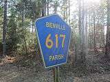 Marker for Bienville Parish Road 617
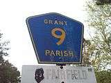 Marker for Grant Parish Road 9 along LA 122
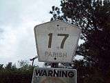 Badly faded parish-installed marker for Grant Parish Road 17, off of LA 8
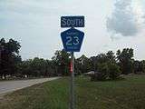 State-installed marker for Rapides Parish Road 23, on the exit from I-49
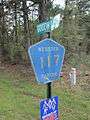 Marker for Webster Parish Road 117
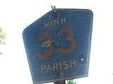 Marker for Winn Parish Road 33, off of LA 1230
See also


References
External links
- Maps / GIS Data Homepage, Louisiana Department of Transportation and Development
| Highway systems | |
|---|---|
| Highway agency | |