Paraoa
 NASA picture of Paraoa Atoll | |
 Paraoa | |
| Geography | |
|---|---|
| Location | Pacific Ocean |
| Coordinates | 19°08′S 140°43′W / 19.133°S 140.717°WCoordinates: 19°08′S 140°43′W / 19.133°S 140.717°W |
| Archipelago | Tuamotus |
| Area |
14 km2 (5.4 sq mi) (lagoon) 4 km2 (1.5 sq mi) (above water) |
| Length | 8.5 km (5.28 mi) |
| Width | 5.5 km (3.42 mi) |
| Administration | |
| Overseas collectivity | French Polynesia |
| Administrative subdivision | Tuamotus |
| Commune | Hao |
| Demographics | |
| Population | Uninhabited[1] (2012) |
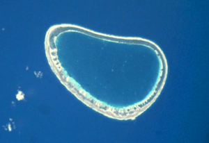
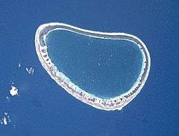
NASA picture of Paraoa Atoll.
Paraoa, Tohora, or Hariri[2] is a small atoll of the central Tuamotu Archipelago in French Polynesia. It is located 76 km south of Hao Atoll's westernmost point. The closest land is Manuhangi Atoll, 52 km to the west.[3]
Paraoa Atoll is oval in shape. It measures 8.5 kilometres (5.3 miles) in length with a maximum width of 5.5 kilometres (3.4 miles). Its lagoon is not connected to the ocean by a pass, which makes this small atoll quite inaccessible. Paraoa Atoll is uninhabited.
History
The first recorded European who arrived to Paraoa was Englishman Samuel Wallis in 1767. He named it "Gloucester".[4]
Administration
Paraoa belongs to the commune of Hao (Main village: Otepa), which includes also Ahunui (uninhabited), Nengonengo, and Manuhangi (uninhabited).
References
- ↑ "Population". Institut de la statistique de la Polynésie française. Retrieved 15 October 2014.
- ↑ Atoll names
- ↑ "Oceandots". Archived from the original on December 23, 2010. Retrieved 2009-03-14.
- ↑ Samuel Wallis (in German)
External links
Tuamotus Gambiers | Islands/Atolls | ||
|---|---|---|---|
| Island groups | |||
This article is issued from
Wikipedia.
The text is licensed under Creative Commons - Attribution - Sharealike.
Additional terms may apply for the media files.