Parakrama Samudra
| Parakrama Samudraya | |
|---|---|
 | |
| Location | Polonnaruwa |
| Coordinates | 7°54′N 80°58′E / 7.900°N 80.967°ECoordinates: 7°54′N 80°58′E / 7.900°N 80.967°E |
| Type | reservoir |
| Catchment area | 75×106 m2 (75 km2; 29 sq mi) |
| Basin countries | Sri Lanka |
| Surface area | 22.6×10⁶ m2 (22.6 km2; 8.7 sq mi) |
| Average depth | 5 m (16 ft) |
| Max. depth | 12.7 m (42 ft) |
| Surface elevation | 58.5 m (192 ft) |
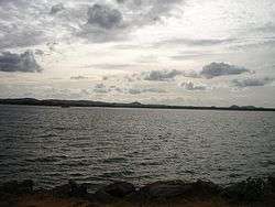
Parakrama Samudra (or King Parakrama's sea or the Sea of King Parakrama) is a shallow reservoir, consisting of five separate reservoirs(thopa, dumbutulu, erabadu,boo, katu tanks) connected by narrow channels in Polonnaruwa, Sri Lanka.
The northernmost reservoir is the oldest and referred to as Topa wewa (Sinhalese wewa = lake or reservoir) built around 386. The middle section Eramudu wewa and the southernmost portion, at the highest elevation, is Dumbutula wewa, both sections were added and the reservoir expanded during the reign of King Parâkramabâhu I.[1]
References
- ↑ PARAKRAMA SAMUDRA (LAKE PARAKRAMA) - International Lake Environment Committee
External links

This article is issued from
Wikipedia.
The text is licensed under Creative Commons - Attribution - Sharealike.
Additional terms may apply for the media files.