Pang Mapha District
| Pang Mapha ปางมะผ้า | |
|---|---|
| Amphoe | |
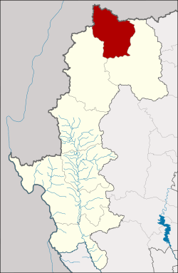 Amphoe location in Mae Hong Son Province | |
| Coordinates: 19°31′21″N 98°14′46″E / 19.52250°N 98.24611°ECoordinates: 19°31′21″N 98°14′46″E / 19.52250°N 98.24611°E | |
| Country | Thailand |
| Province | Mae Hong Son |
| Seat | Sop Pong |
| Area | |
| • Total | 798.375 km2 (308.254 sq mi) |
| Population (2005) | |
| • Total | 19,708 |
| • Density | 24.7/km2 (64/sq mi) |
| Time zone | UTC+7 (ICT) |
| Postal code | 58150 |
| Geocode | 5807 |
Pang Mapha (Thai: ปางมะผ้า, pronounced [pāːŋ mā.pʰâː]) is the northernmost district (amphoe) of Mae Hong Son Province, northern Thailand.
Etymology
In the Shan language, "mapha" or "makpha" (มะผ้า or หมากผ้า) means 'lime' and "pang" means 'hill', so a translation into English might be 'lime hill'.
History
Several prehistoric sites are known within the Pang Mapha area.[1] The most famous one is the Spirit Cave, discovered by Chester Gorman in the mid-1960s, was occupied from about 9000 till 5500 BCE by Hoabinhian hunters and gatherers. Two other significant sites nearby are the Banyan Valley Cave and the Steep Cliff Cave. Much more recent are the coffin caves like Tham Lot.
During World War II Japanese troops built a road from Pai to Mueang Mae Hong Son and further to Burma. Later people used the road for transport, using Ban Soppong Mae Umong (บ้านสบป่องแม่อูมอง) as the overnight stop. The government built a police station in the area that called Pang Mapha in 1948. In 1977 the government improved the road, many people from other districts and provinces, hill tribes and refugees from Myanmar moved to the area. This created problems like drug trafficking and deforestation. To improve the administration of the area, the government created the Pang Mapha minor district (king amphoe) on 1 April 1987, by splitting the two tambon Sop Pong and Pang Mapha from Mueang Mae Hong Son District.[2] It was upgraded to a full district on 5 December 1996.[3]
Geography
The Daen Lao Range dominates the landscape of this district. Neighboring districts are (from southeast clockwise) Pai, Mueang Mae Hong Son of Mae Hong Son Province and Shan State of Myanmar.
The main river of the district is the Khong River.
Administration
The district is divided into four sub-districts (tambon), which are further subdivided into 38 villages (muban). There are no municipal (thesaban) areas, and four tambon administrative organizations (TAO).
| No. | Name | Thai name | Villages | Pop. | |
|---|---|---|---|---|---|
| 1. | Sop Pong | สบป่อง | 8 | 7,398 | |
| 2. | Pang Mapha | ปางมะผ้า | 11 | 4,017 | |
| 3. | Tham Lot | ถ้ำลอด | 7 | 3,784 | |
| 4. | Na Pu Pom | นาปู่ป้อม | 12 | 4,509 |
References
- ↑ Wipatayotin, Apinya (11 February 2018). "Finding common ground" (Spectrum). Bangkok Post. Retrieved 11 February 2018.
- ↑ ประกาศกระทรวงมหาดไทย เรื่อง แบ่งเขตท้องที่อำเภอเมืองแม่ฮ่องสอน จังหวัดแม่ฮ่องสอน ตั้งเป็นกิ่งอำเภอปางมะผ้า (PDF). Royal Gazette (in Thai). 104 (67 ง): 2485. April 9, 1987.
- ↑ พระราชกฤษฎีกาตั้งอำเภอเหนือคลอง อำเภอนายายอาม อำเภอท่าตะเกียบ อำเภอขุนตาล อำเภอแม่ฟ้าหลวง อำเภอแม่ลาว อำเภอรัษฎา อำเภอพุทธมณฑล อำเภอวังน้ำเขียว อำเภอเจาะไอร้อง อำเภอชำนิ อำเภอโนนดินแดง อำเภอปางมะผ้า อำเภอสนธิ อำเภอหนองม่วง อำเภอเบญจลักษ์ อำเภอโพนนาแก้ว อำเภอบุ่งคล้า อำเภอดอนมดแดง และอำเภอลืออำนาจ พ.ศ. ๒๕๓๙ (PDF). Royal Gazette (in Thai). 113 (62 ก): 5–8. November 20, 1996.
External links

- amphoe.com
- https://web.archive.org/web/20070310200805/http://cddweb.cdd.go.th/pangmapha/ (Thai)
- Photo Gallery from the Telegraph (UK)
- "Sop Pongs Secrets". Citylife Chiang Mai.