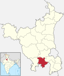
Palhawas is situated in Rewari district, which is about 21.5 km from Rewari town. It is on Rewari- Jhajjar road at 21.5 kilometres (13.4 mi) distance from Rewari in Rewari block. Palhawas is a Village in Rewari Tehsil in Rewari District of Haryana State, India.It also have palhawas railway station on rewari-rohtak railway line.now palhawas is sub-tehsil.
Demographics =99.9% it is Hindu community village
Places =six lakes ,three ashrams, one water supply station, one electricity power station, police chowki, small cloth market,
Demographics of 2011
As of 2011 India census, Palhawas, Rewari had a population of 4463 in 890 households. Males (2301) constitute 51.55% of the population and females (2162) 48.45%. Palhawas has an average literacy (3800) rate of 85%, higher than the national average of 74%: male literacy (2000) is 86%, and female literacy (1800) is 83% of total literates (3800). In Palhawas, Rewari, 13.08% of the population is under 6 years of age (584).[1]
References
Villages of Rewari District |
|---|
| Jatusana Block of Rewari |
- 1. Asiaki Gorawas
- 2.Aulant
- 3.Babdoli
- 4.Balawas Jamapur
- 5.Baldhan Kalan
- 6.Baldhan Khurd
- 7.Berli Kalan
- 8.Berli Khurd
- 9.Biharipur, Rewari
- 10.Bohatwas Bhondu
- 11.Boria Kamalpur
- 12.Chandanwas
- 13.Chowki No. 1
- 14.Chowki No. 2
- 15.Dahina
- 16.Dakhora
- 17.Daroli, Rewari
- 18.Dehlawas
- 19.Didoli
- 20.Kahari, Rewari
- 21.Dohkia
- 22.Fatehpuri Tappa Dahina
- 23.Gadhla
- 24.Gopal Pur Gazi
- 25.Gothra Tappa Dahina
- 26.Gulabpura, Rewari
- 27.Gurawra
- 28.Haluhera
- 29.Hansawas
- 30.Jatusana
- 31.Jeewra
- 32.Kanhora
- 33.Kanhori
- 34.Kanwali
- 35.Karawra Manakpur
- 36.Khera Alampur
- 37.Khushpura
- 38.Kumbrodha
- 39.Lala, Rewari
- 40.Lisan
- 41.Mandhia Khurd
- 42.Maseet
- 43.Mastapur
- 44.Mohdinpur
- 45.Motla Kalan
- 46.Motla Khurd
- 47.Murlipur
- 48.Musepur
- 49.Nain Sukhpura
- 50.Nangal Mundi
- 51.Nangal Pathani
- 52.Nanglia Ranmokh
- 53.Pahrajwas
- 54.Palhawas
- 55.Parkhotampur
- 56.Qutubpuri Bujurg
- 57.Rampuri, Rewari
- 58.Rasuli
- 59.Rohrai
- 60.Rojhuwas
- 61.Shadipur, Rewari
- 62.Sihas
- 63.Suma Khera
- 64.Tehana Depalpur
- 65.Maliaki
- 66.Rajawas
- 67.Nurpur, Rewari
- 68.Chang, Rewari
- 69.Chag, Rewari
- 70.Saidpur, Rewari
- 71.Jaruwas
- 72.Mundanwas
- 73.Prithvipura
| |
|---|
| Nahar Block of Rewari |
- 1.Ahamdpur Parthal(Nahar)
- 2.Bahala
- 3.Bahrampur
- 4.Bass Rattanthal
- 5.Bawwa
- 6.Bhakli
- 7.Bharangi
- 8.Bhurthala
- 9.Bishoha
- 10.Chhawa
- 11.Dharoli
- 12.Garhi
- 13.Gudiani
- 14.Gughod
- 15.Gujarwas
- 16.Jahidpur Tappa Kosli
- 17.Jakhala
- 18.Jhal
- 19.Jharoda
- 20.Jholri
- 21.Juddi
- 22.Kanharwas
- 23.Karoli
- 24.Kheri
- 25.Khurshid Nagar
- 26.Koharar
- 27.Kosli
- 28.Lilodh
- 29.Lukhi similar name Lookhi
- 30.Lula Ahir
- 31.Mumtajpur
- 32.Mundra
- 33.Nahar
- 34.Nangal
- 35.Nathera
- 36.Naya Gaon
- 36.Nehru Garh
- 38.Rattanthal
- 39.Shadat Nagar
- 40.Shadipur
- 41.Sham Nagar
- 42.Sudhrana
- 43.Surakhpur Tappa Kosli
- 44.Surheli
- 45.Tumna
- 46.Ushmapur
- 47.Bhuriawas
- 48.Bir Sarkar
- 49.Malesiyawas
|
|---|
| Rewari Block of Rewari District | |
|---|
| Khol Block of Rewari |
- 1.Aaliawas
- 2.Ahrod
- 3.Balwari
- 4.Bass
- 5.Bass Dudha
- 6.Bawana Gujar
- 7.Bhalkhi
- 8.Bhandor
- 9.Bhathera
- 10.Bithori
- 11.Bohatwas Ahir
- 12.Bohka
- 13.Buroli
- 14.Cheeta Dungra
- 15.Chimnawas
- 16.Dhamlawas
- 17.Dhani Santo
- 18.Dhani Sobha
- 19.Dhani Sundroj
- 20.Dhani Thather Bad
- 21.Dhawana
- 22.Goliaka
- 23.Gopalpur urf Pranpura
- 24.Gothra Tappa Khori similar Gothra
- 25.Gumina
- 26.Harjipur
- 27.Khaleta
- 28.Khol
- 29.Khori
- 30.Kolana
- 31.Kundal
- 32.Lohana
- 33.Mailawas
- 34.Majra Mustal Bhalkhi
- 35.Mamaria Ahir
- 36.Mamaria Asampur
- 37.Mamaria Thethar
- 38.Mandola
- 39.Manethi
- 40.Mayan
- 41.Mundi
- 42.Nandha
- 43.Nangal Jamalpur
- 44.Nimoth
- 45.Padla
- 46.Pali
- 47.Pithrawas
- 48.Pranpura
- 49.Punsika
- 50.Rajiaka
- 51.Rajpura Istmurar
- 52.Roliawas
- 53.Shahbajpur Istmurar
- 54.Siha, Rewari
- 55.Sundroj
- 56.Tint
- 57.Uncha (Dhani Jawarat)
- 58.Zainabad
- 59.Nangla Mayan
- 60.Govindpuri
- 61.Bangrawa
- 62.Siri Nagar
- 63.Kadhu (Bhawanipur)
- 64.Makhria
- 65.Bad Jathu
- 66.Bad Sundroj
|
|---|
| Bawal Block of Rewari | |
|---|
 Portal: Haryana Portal: Haryana Category: Haryana Category: Haryana Wikiproject: Haryana Wikiproject: Haryana
|