Palavecino Municipality
| Palavecino Municipality Municipio Palavecino | ||
|---|---|---|
| Municipality | ||
| ||
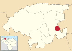 Location in Lara | ||
.svg.png) Palavecino Municipality Location in Venezuela | ||
| Coordinates: 10°01′59″N 69°15′48″W / 10.0331°N 69.2633°WCoordinates: 10°01′59″N 69°15′48″W / 10.0331°N 69.2633°W | ||
| Country |
| |
| State | Lara | |
| Municipal seat | Cabudare | |
| Government | ||
| • Mayor | Aura Contreras de Rivero (MVR) | |
| Area | ||
| • Total | 440 km2 (170 sq mi) | |
| Population (2007) | ||
| • Total | 155,653 | |
| • Density | 350/km2 (920/sq mi) | |
| Time zone | UTC−04:00 (VET) | |
| Area code(s) | 0251 | |
| Website | Official website | |

The Palavecino Municipality is one of the nine municipalities (municipios) that makes up the Venezuelan state of Lara and, according to a 2007 population estimate by the National Institute of Statistics of Venezuela, the municipality has a population of 155,653.[1] The town of Cabudare is the shire town of the Palavecino Municipality.[2]
Demographics
The Palavecino Municipality, according to a 2007 population estimate by the National Institute of Statistics of Venezuela, has a population of 155,653 (up from 137,294 in 2000). This amounts to 8.7% of the state's population.[3] The municipality's population density is 353.76 inhabitants per square kilometre (916.2/sq mi).[4]
Government
The mayor of the Palavecino Municipality is Aura Contreras de Rivero, elected on October 31, 2004 with 32% of the vote.[5] She replaced Diego Antonio Rivero shortly after the elections.[6] The municipality is divided into three parishes; Cabudare, José Gregorio Bastidas, and Agua Viva .[2]
See also
References
- ↑ http://www.ine.gob.ve/sintesisestadistica/estados/lara/cuadros/Poblacion6.xls%5Bpermanent+dead+link%5D
- 1 2 http://www.ine.gob.ve/secciones/division/Lara.zip%5Bpermanent+dead+link%5D
- ↑ http://www.ine.gob.ve/sintesisestadistica/estados/lara/cuadros/Poblacion5.xls%5Bpermanent+dead+link%5D
- ↑ http://www.ine.gob.ve/sintesisestadistica/estados/lara/cuadros/Poblacion4.xls%5Bpermanent+dead+link%5D
- ↑ http://www.cne.gob.ve/regionales2004/11/alcaldedis=0&edo=11&mun=5&par=0&cen=0&mesa=0&cua=0.html
- ↑ http://www.cne.gob.ve/estadisticas/e016.pdf
External links
- palavecino-lara.gob.ve (in Spanish)