Pakaraka
| Pakaraka | |
|---|---|
 Pakaraka | |
| Coordinates: 35°21′27″S 173°57′23″E / 35.35750°S 173.95639°E | |
| Country | New Zealand |
| Region | Northland Region |
| District | Far North District |

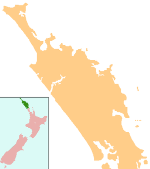
Pakaraka is a settlement in Northland, New Zealand, at the junction of State Highway 1 and 10, in the district the Ngāpuhi tribe called Tai-a-mai.[1]
A pā was located at the base, and on the slopes, of Pouerua, a 270 metres (890 ft) high basaltic scoria cone. The pā was studied during a major archeological project in the 1980s.[2]
Parts of the Flagstaff War were fought around Pakaraka in 1845.[3] After the Battle of Ohaeawai on 23 June 1845 the British troops destroyed Te Haratua's pā at Pakaraka on 16 July 1845.[4]
Notable people
- Hone Heke, a Ngāpuhi chief, was born at Pakaraka in about 1807 or 1808.[5] He was buried here in secret in August 1850. In 2011 his remains were removed due to possible development of the land around the burial site.
- The missionary Henry Williams retired to Pakaraka and built a church in 1850-51. The church that now stands on the site was opened on 27 November 1873,[6] the church was constructed by Williams' wife and family as a memorial to his life.[7] The church is named Holy Trinity Church as Trinity Sunday was the day on which Henry was ordained by the Bishop of London, and Trinity Sunday was also the last day that Henry and Marianne Williams spent at Paihia before moving to Pakaraka. They lived by the church in a house known as The Retreat, that still stands.[8]
- The first and third sons of the missionary Henry Williams, Edward & Henry farmed here.
Historic places
Mount Pouerua is registered with the Historic Places Trust as a traditional site (Registration Number 6711). Also listed by the Historic Places Trust are: Holy Trinity Church (Registration Number 65); The Retreat (Registration Number 70); and the Store (Registration Number 419).[9]
Education
Pakaraka School is a coeducational full primary (years 1-8) school with a roll of 59.[10] 56% of the students are Māori.[11]
Coordinates: 35°21′27″S 173°57′23″E / 35.35750°S 173.95639°E
Gallery
- Holy Trinity Church at Pakaraka
 Gravestones of Henry and Marianne Williams, Holy Trinity Church
 Interior of the Holy Trinity
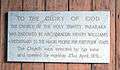 A plaque in the church
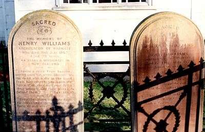 Gravestones of Henry and Marianne Williams
Notes
- ↑ Best, Elsdon (1927). "Old Forts of the Taiamai District, Bay of Islands". The Pa Maori. Whitcombe and Tombs Limited.
- ↑ Doug G. Sutton; Louise Furey; Yvonne M. Marshall (2003). The archaeology of Pouerua. Auckland University Press. ISBN 1-86940-292-8.
- ↑ Reverend Robert Burrows (1886). "Extracts from a Diary during Heke's War in the North in 1845".
- ↑ Cowan, James (1922). "Volume I: 1845–1864". The New Zealand Wars: a history of the Maori campaigns and the pioneering period. Wellington: R.E. Owen. pp. 73–144.
- ↑ "Heke Pokai, Hone Wiremu". Dictionary of New Zealand Biography.
- ↑ "The Church Missionary Gleaner, May 1874". Opening of a new church in New Zealand. Adam Matthew Digital. Retrieved 24 October 2015. (Subscription required (help)).
- ↑ "Holy Trinity, Pakaraka, Northland". Don Donovan.
- ↑ "The Retreat (Pakaraka)". Henry and William Williams Memorial Museum Trust. Retrieved 28 January 2015.
- ↑ "New Zealand Heritage List/Rārangi Kōrero". Historic Places Trust. Retrieved 28 January 2015.
- ↑ Te Kete Ipurangi schools database: Pakarata School
- ↑ "Pakaraka School". Education Review Office. 23 October 2014.