Packsaddle, New South Wales
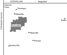
Map of Packsaddle, New South Wales
Packsaddle, New South Wales is a remote rural locality, suburb and civil parish of Evelyn County, New South Wales.
The parish was calculate at 318500 acres.
A settlement is located where the Silver City Highway crosses the Packsaddle Creek.
The name is said by some to have been given by Burke and Wills who lost a packsaddle crossing the creek upstream from the modern hamlet.
The area was owned by Goldborough Mort and Co in the 1890s, and Kidman in the 1920s.[1]
A gymkhana is held at Easter time.[2]
The parish has a Köppen climate classification of BWh (Hot desert)[3].
References
- ↑ Packsaddle Roadhouse (Caravan, Camping & Cabins).
- ↑ Packsaddle, Outback NSw.
- ↑ Peel, M. C.; Finlayson, B. L.; McMahon, T. A. (2007). "Updated world map of the Köppen–Geiger climate classification". Hydrol. Earth Syst. Sci. 11: 1633–1644. doi:10.5194/hess-11-1633-2007. ISSN 1027-5606. (direct: Final Revised Paper)
This article is issued from
Wikipedia.
The text is licensed under Creative Commons - Attribution - Sharealike.
Additional terms may apply for the media files.