Puerto Rico Highway 9
| ||||
|---|---|---|---|---|
| Anillo de Circunvalación de Ponce | ||||
| Route information | ||||
| Maintained by DTOP | ||||
| Length | 7.27 km[1] (4.52 mi) | |||
| Existed | 2006 – present | |||
| Major junctions | ||||
| North end |
| |||
|
| ||||
| South end |
| |||
| Highway system | ||||
| ||||


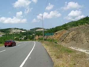
Puerto Rico Highway 9, also called the Anillo de Circunvalación de Ponce[2][3] (Ponce's Circumferential Highway), is a limited-access state[4] highway located entirely within the limits of the municipality of Ponce, Puerto Rico, and connecting Puerto Rico Highway 10 in Barrio Portugués in the north to Puerto Rico Highway 52 in barrio Canas in the south, crossing Barrio Magueyes. The Oficina de Ordenacion Territorial (Office of Territorial Ordering) of the Autonomous Municipality of Ponce calls this road Ronda de Circunvalacion Roman Baldorioty de Castro (Roman Baldorioty de Castro Beltway).[5][6] The roadway is still under construction.
History
PR-9 is being built in sections. There are three sections, PR-10 to PR-123, PR-123 to PR-132, and PR-132 to PR-163. For construction purposes each section was further divided into segments. On 13 October 2000, governor Pedro Rossello inaugurated the last segment needed for connecting the section linking PR-10, in barrio Portugues, to PR-123,[note 1] in barrio Magueyes, and consisting of 7.27 km, at a cost of $22 million.[7] In October 2012, the Puerto Rico Department of Transportation and Public Works revealed that the last track of PR-9, one that would connect PR-10 to PR-52 and consisting of 2.6 kilometers, was soon to commence construction at a cost of $46 million.[3]
In December 2013, the section from PR-123 to PR-132 (known as Autoridad de Carreteras (AC)'s project number 000911) was projected for a 2014-2018 budget cost of $29,881,816. [8] Construction of PR-9 from Avenida Las Américas (PR-163) to PR-132 was likewise AC's # 000915 and estimated at $40,325,706.
In February 2015, the section from PR-123 to PR-132 was initially projected to cost $38.5 million and was planned to be ready in 2016.[9] Project overruns, due to landslides and other unexpected factors, increased the cost of this section from $38.5 million to $41.7 million, and pushed the schedule opening date to February 2018.[10]
Also in February 2015, the last section of the road which would connect PR-132 with Avenida Las Américas, Avenida Baramaya, and PR-52, was planned to be built at a cost of $45 million. As of February 2014, this final section was scheduled for completion by early 2018.[11]
Route description
PR-9 is still partly under construction. The construction work has thus far yielded the extreme northern and southern segments, with the middle segments still to be built. The road currently runs mostly northwest of the city as well as southwest of the city. The western segment is still being built. This last segment has a length of 4.23 kilometers.[12][13]
When completed, it will have the effect of creating a beltway around the city, given that PR-9 connects with PR-10 at its northern extreme, and PR-10 already borders the city around its northern, northeastern, and eastern edges. This beltway will have junctions with all major city highways: from PR-52 and PR-2 in west Ponce to PR-52 and PR-1 in east Ponce.[14]
Major junctions
The five exits existing so far are PR-52, PR-2, PR-163 in the southwestern segment, and PR-123 and PR-10 in the northwestern segment. When completed, the road will have six exits in this sequence from north to south: PR-10, PR-123, PR-132, PR-163, PR-2, and PR-52.
The junction list is as follows:
Construction
The building of PR-9 is taking place in several phases. Phase I, already completed, consisted of the stretch of the road from PR-10 in Barrio Portugués to PR-123 in Barrio Magueyes.
Phase II consists of the stretch between PR-123 at barrio Magueyes to PR-132 in Barrio Canas. As of August 18, 2010, the Phase II stretch was in the planning phase according to Puerto Rico's Commissioner of Transportation and Public Works, Rubén A. Hernández Gregorat. Phase II is expected to cost $28 million.[15] The length of this section is 2.61 kilometers. It includes three bridges: one will cross Río Canas, a second one will be an overpass for PR-123, and a third bridge will cross the access ramp to PR-123.[16]
Phase III of PR-9 will run from PR-132 in Canas to PR-163 (with a connection to Avenida Las Américas) in barrio Canas Urbano. It is expected to cost some $36 million. This section will have a length of 1.62 kilometers, and will require three bridges: One will be an overpass to Las Americas Avenue at PR-163, one crossing Rio Pastillo, and one crossing PR-132.
The fourth and last portion of this project, Phase IV will consist of a stretch between PR-163 and PR-2 via improvements to the existing 4-lane Avenida Baramaya roadway.[15]
Completion of this last phase will make it possible to circumvent city traffic altogether by providing a loop around Ponce for motorists wishing access to areas north and northeast of the city from PR-2 in the El Tuque sector of barrion Canas.[15] It will, for example, be possible to travel from Mayaguez to Adjuntas without the need to travel on the eastern segment of PR-10 near Mercedita Airport, which is currently (July 2017) the case.
Notes
- ↑ PR-123 was signed as "PR-10" in this area until the opening of a new road that adopted the PR-10 designation and which, like PR-123, runs from Ponce to Arecibo.
References
- ↑ Inauguran conector con la PR-10 del sur. Sandra Caquías Cruz. El Nuevo Dia. Guaynabo, Puerto Rico. 14 October 2000. Accessed 15 February 2018
- ↑ Puerto Rico Route PR-9 circling Ponce renamed after Churumba
- 1 2 Abre de forma parcial puente de la PR-2. Carmen Cila Rodríguez. La Perla del Sur. Ponce Puerto Rico. Year 30. Issue 1506. Page 4. (Name in printed edition: "Tras dos anos de obras: Abre de formal parcial nuevo tramo de la PR-2.") 10 October 2012. Retrieved 10 October 2012.
- ↑ ¿Una avenida o zona de combate? Primera Hora. 19 June 2014. Retrieved 24 June 2014.
- ↑ Anillo de Circunvalacion. Office of Territorial Ordering. Autonomous Municipality of Ponce. Retrieved 5 August 2011.
- ↑ Avanza Construccion del Anillo de Circunvalacion. Amado Vega Velazquez. Periodico El Señorial. Government of the Municipality of Ponce, Puerto Rico. Año 2014. Edicion Especial. May 2014. page 3. Retrieved 13 August 2014.
- ↑ Inauguran conector con la PR-10 del sur. 14 October 2000. El Nuevo Dia. Sandra Caquías Cruz. Accessed 15 February 2011.
- ↑ Part Two: The Transportation Planning Regions - Context and Cost-Feasible Plans: South and Southeast. "Puerto Rico's Five Transportation Planning Regions (TPRS): 2040 Long Range Transportation Plans." Puerto Rico Department of Transportation. December 2013. Page 7-52. Accessed 19 September 2018.
- ↑ Sin fecha para repavimentar la PR-10. Jason Rodríguez Grafal. La Perla del Sur. Ponce, Puerto Rico. Year 32. Issue 1629. Pages 6-7. 18 February 2015. Retrieved 18 February 2015. Weblink updated 12 May 2018.
- ↑ Una vez más: Se aleja la fecha de apertura para el Anillo de Circunvalación. Jason Rodríguez Grafal. La Perla del Sur. Ponce, Puerto Rico. Year 35. Issue 1754. Pages 6-7. 12 July 2017. Retrieved 12 July 2017.
- ↑ Sin fecha para repavimentar la PR-10. Jason Rodríguez Grafal. La Perla del Sur. Ponce, Puerto Rico. Year 32. Issue 1629. Pages 6-7. 18 February 2015. Retrieved 18 February 2015. Weblink updated 12 May 2018.
- ↑ Availability of Environmental Document and Opportunity to request a Public Hearing for the Construction of PR-9 from Baramaya Avenue to PR-123, Municipality of Ponce, Puerto Rico. Puerto Rico Department of Transportation and Public Works, Puerto Rico Highway and Transportation Authority. Public Notice.
- ↑ Availability of Environmental Document and Opportunity to request a Public Hearing for the Construction of PR-9 from Baramaya Avenue to PR-123, Municipality of Ponce, Puerto Rico. Puerto Rico Department of Transportation and Public Works, Puerto Rico Highway and Transportation Authority. Public Notice.
- ↑ General Purpose Population Data, Census 2000. Unidad de Sistemas de Información Geográfica, Área de Tecnología de Información Gubernamental, Oficina de Gerencia y Presupuesto. Gobierno de Puerto Rico. Archived 12 August 2010 at the Wayback Machine. Retrieved February 20, 2010.
- 1 2 3 Inauguran e inician importantes obras de infraestructura vial en Ponce. Comunicado de Prensa (Press Release). August 18, 2010. Ponce, Puerto Rico. Government of Puerto Rico. Departamento de Transportacion y Obras Publicas.
- ↑ Puerto Rico Department of Transportation. 10-SEPTIEMBRE-2010: AVISO PUBLICO.